|

GLOSSARY OF
WEATHER TERMS:

Have you ever wondered what the difference is between
rain, showers and drizzle?
Many people believe that meteorologists use these terms
indiscriminately, assuming that if it "rains" or if there is a "chance of
showers," it's time to get out the umbrella.
In fact, these terms have their own specific meanings.
A better understanding of weather terminology will help
with planning outdoor activities throughout the year.
To that end, a glossary of all the weather terms used in
the current conditions and forecasts has been prepared, so that you can get
the most out of your forecasts and then some.
For complete 'A-Z' glossary of weather
(meteorological) terms, visit our Online Store.
The "Wx-Course" Pro;
Online Product #0017.
A
Glossary courtesy of
The "Wx-Course" Pro;
Online Product #0017.
"Absolute
Humidity"
A mass of water vapor in a given volume of air.
"Acre Foot"
The amount of water needed to cover one acre
under a foot of water.
"Adiabatic
Process"
This is the process by which fixed
relation- ships are maintained during changes in temperature, volume,
and pressure in a body of air, without heat being added or removed. The
change in air temperature caused by pressure
changes as air rises or sinks.
"Advection"
Horizontal movement of any meteorological
property, such as warmth or humidity.
"Advection Fog"
A type of fog caused by the movement of moist
air over a cold surface, and the consequent cooling of that air to below its
dew point. Sea fog is one type of advection fog that involves moist air in
transport over a cold body of water.
"Aeronomy"
The science of the physics and chemistry of upper atmospheres of
planets, including earth.
"A Few Clouds"
Scattered clouds, with clear skies dominant.
Cloud cover between 1/8 and 2/8.
"Ageostrophic Flows"
Air flows that move across isobars or height
contours at an angle toward either high or low pressure.
"Air Mass"
In meteorology, an extensive body of air within
which the conditions of temperature and moisture in a horizontal plane are
essentially uniform.
"Altimeter"
A special type of aneroid barometer used in
airplanes to measure altitude.
"Altitude, Density"
The altitude in the standard atmosphere at
which the air has the same density as the air at the point of question. An
aircraft will have the same performance characteristics as it would have in
a standard atmosphere at this altitude.
"Altitude, Pressure"
The altitude in the standard atmosphere at
which the pressure is the same as at the point if question. Since an
altimeter operates solely on pressure, this is the uncorrected altitude
indicated by an altimeter set at standard sea level pressure of 29.92 inches
or 1013 millibars.
"A Mix of Sun and Clouds"
At times there will be more clouds than sun, and at other times there
will be more sun than clouds. Cloud cover between 3/8 and 7/8.
"Anemometer"
An instrument for measuring wind speed.
"Aneroid"
Not using liquid. An aneroid barometer has a
needle connected to the top of a small box that has had some of its air
taken out. A change in air pressure moves the box lid up and down, and this
moves the needle. The air pressure can be read from the needle’s position on
a scale.
"Aneroid Barometer"
A device to measure air pressure that uses an
aneroid, which is sealed, flexible metal bellows with some air removed that
expands and contracts with air pressure changes.
"Antarctic Circle"
Latitude 66 degrees, 32 minutes south. Area to
the south is the Antarctic.
"Anticyclone"
An area of high pressure. The winds of an
anticyclone blow in a spiral outward from the center.
"ASOS"
Automated Surface Observation System. A suite
of weather instruments that automatically report certain weather conditions,
such as sky cover, temperature, and wind.
"Atmosphere"
The layer of gases, or air, that surrounds the
earth. The atmosphere is made up mostly of the gases nitrogen and oxygen.
"Atmospheric Pressure"
Also called barometric pressure. The pressure exerted by the
atmosphere as a consequence of gravitational attraction exerted upon the
"column" of air lying directly above the point in question.
B
Glossary courtesy of
The "Wx-Course" Pro;
Online Product #0017.
"Back-Door Cold Front"
A cold front that moves from the
northeast, instead of the more usual northwest or north, in the
eastern United States.
"Barograph"
A device for recording air pressure.
"Barometer"
A device used for measuring air pressure.
"Barometric Pressure"
The pressure exerted by the weight of the
column of air above a given point, expressed in pounds per square inch,
inches of mercury, millibars, or kilopascals.
"Beaufort Wind Scale"
Scale used to classify wind speed, devised in
1805 by British Admiral Francis Beaufort to classify winds at sea.
"Biosphere"
The Earth’s living things.
"Blizzard"
Snow falling with winds faster than 35 mph and
visibility of one-quarter mile or less over an extended time period.
"Blizzard Conditions"
A storm with an air temperature below -1 F(-18
C), with snowfall resulting in significant accumulations, and strong winds.
The winds will produce severe wind chill values, blowing snow and whiteouts.
Visibility will be severely reduced and roadways can be slippery, resulting
in very dangerous driving conditions. Stay home.
"Blowing Snow"
Created when high winds lift snow from the surface and
blow it to heights of 6 feet (2 meters) or more. No snow will be falling,
but visibility may be severely reduced and roadways can be slippery.
C
Glossary courtesy of
The "Wx-Course" Pro;
Online Product #0017.
"Calcium Magnesium Acetate"
A chemical compound used used to melt ice.
"Carbon Dioxide"
A colorless, odorless gas given out by animals
when they breath. This gas is taken in by plants, which give out oxygen.
"Ceilometer"
A cloud height measuring system. It projects
light on the cloud, detects the reflection by a photoelectric cell, and
determines eight by triangulation.
"Celsius Temperature Scale"
Abbreviated C. A temperature scale with zero
degrees as the melting point of pure ice and 100 degrees as the boiling
point of pure water at standard sea level atmospheric pressure.
"Chaos Theory"
The theory that some systems, such as weather,
are ultimately unpredictable because of the effects of small-scale events
that can’t be included in the prediction equations.
"Chinook"
A warm, dry foehn wind blowing down the eastern
slopes the Rocky Mountains over the adjacent plains in the United States and
Canada.
"Chinook Effect"
The temperature response to down slope winds.
Most often used in the context of the Rocky Mountains, Chinook effects can
increase surface temperatures by 20 to 40 degrees Fahrenheit in as little as
15 minutes. The temperature increase is the result of subsiding air, which
heats up and lowers humidities as it flows down the leeward slopes of a
prominent mountain or ridge.
"Chlorofluorocarbons"
Also known as CFC’s. Man-made substance used as
coolant and computer-chip cleaner, which have been shown to destroy
stratospheric ozone when they break down.
"Chromosphere"
A thin layer of gas on the sun’s surface.
"Cirrocumulus"
A cirriform cloud appearing as a thin sheet of
small white puffs resembling flakes or patches of cotton without shadows;
sometimes confused with altocumulus.
"Cirrostratus"
A cirriform cloud appearing as a whitish veil,
usually fibrous, sometimes smooth; often produces halo phenomena; may
totally cover the sky.
"Cirrus"
A cirriform cloud in the form of thin, white
feather-like clouds in patches or narrow bands; have a fibrous and/or silky
sheen; large ice crystals often trail downward a considerable vertical
distance in fibrous, slanted, or irregularly curved wisps called mares’
tails.
"Clear Air Turbulence"
Abbreviated CAT. Turbulence encountered in air
where no clouds are present; more popularly applied to high level turbulence
associated with wind shear.
"Clear"
Skies will be almost totally clear, perhaps
with a few small light clouds visible. Cloud cover will be between 0 and
1/10. Clear is the nighttime term equivalent to "Sunny".
"Clearing"
Most of the sky will be covered in clouds, but
you will see more and more sunshine throughout the forecast period. It will
take only a portion of the period for the sky to become less than half
covered in clouds.
"Clear with Cloudy Periods"
The nighttime equivalent of "Sunny with Cloudy
Periods".
"Climate"
An established, distinct pattern of weather
conditions that exists in a place over a period of many years; Average
weather over a long time period, usually 30 years.
"Climate Model"
Mathematical model containing equations that
describe climatic interactions.
"Cloud"
Moisture in the air that has condensed onto
particles of dust or smoke.
"Cloud Seeding"
The use of silver iodide, dry ice or other
substances to enhance precipitation.
"Clouding Over"
Skies will be mostly clear, but more and more
cloud cover will develop throughout the forecast period. The sky will become
completely overcast before the end of the forecast period.
"Cloudy"
No sunshine visible. Cloud cover will be 5/8 or
more.
"Cloudy with Clear Breaks"
The nighttime equivalent of "Cloudy with Sunny
Breaks".
"Cloudy with Drizzle"
The sky will be overcast and a heavy mist or
very light continuous rain is expected to fall. Your slow pulse wipers will
be too fast in clearing the windshield.
"Cloudy with Flurries"
The cloud cover will be as described for
"Cloudy", and the precipitation light. The flurries will be short-lived and
intermittent, and will not amount to any significant accumulation on the
ground. Visibility will be reduced, but roadways will not generally be
slippery.
"Cloudy with Freezing Drizzle"
Similar to freezing rain, but the size of the
supercooled rain drops will be less than .02 inch diameter (0.5 mm). The
effects will be the same as for "Freezing Rain", but the buildup of ice will
be slower.
"Cloudy with Freezing Rain"
The sky condition will be as described above,
with precipitation consisting of supercooled liquid rain drops that
instantly freeze on contact. Visibility will generally be good, but roadways
will be extremely slippery and dangerous. Freezing rain will create a layer
of ice on bare surfaces and existing snow.
"Cloudy with Isolated Flurries"
The cloud cover will be as described for
"Cloudy", and the precipitation very light. The flurries will be brief and
intermittent, and will not amount to any significant accumulation on the
ground. Visibility will be reduced, but roadways will not generally be
slippery.
"Cloudy with Light Rain"
The sky will be overcast and the precipitation
will be strong enough to get things wet in a short time. The rain will
interfere with outdoor activities. Puddles will form quickly and water may
run down the expressways, causing slippery road conditions. Precipitation
will persist throughout the forecast period.
"Cloudy with Light Snow"
The cloud cover will be as described for
"Cloudy", the precipitation light. The snow will be continuous but will not
usually amount to any significant accumulations for the forecast period.
Visibility will be reduced and roadways can be slippery, depending on the
duration of the snow.
"Cloudy with Periods of Rain"
The sky will be overcast and the precipitation
strong enough to get things wet in a short time, but the rain may also stop
for a short period of time. The rain will interfere with outdoor activities.
The ground will get wet, puddles will form, but the precipitation will be
expected to cease for short periods of time over the forecast period.
"Cloudy with Rain or Snow Showers"
The type of precipitation expected to fall can
either be rain or snow throughout the forecast period. The precipitation
starts and stops. No significant accumulations are expected. If the
precipitation falls as snow, visibility will be reduced and roadways can
become slippery.
"Cloudy with Scattered Thundershowers"
The sky will be cloudy, with some showers or
light rain possible; thunder and lightning will be associated with the
precipitation. The showers or rain may be heavy for short periods of time.
"Cloudy with Showers"
The sky will be overcast and the strength of
the precipitation will be light. The showers will be intermittent, and will
generally interfere with outdoor activities. The ground will get wet.
"Cloudy with Sunny Breaks"
A least half covered in clouds, but not totally
cloudy. Cloud cover will be between 5/8 to 7/8.
"Cloudy with Thundershowers"
The sky will become cloudy with a few showers
or light rain possible; thunder and lightning will be associated with the
precipitation. The showers or rain may be heavy for extended periods of
time.
"Cloudy with Thunderstorms"
The sky will be cloudy, with showers or light
rain possible; thunder and lightning will be associated with the
precipitation. The showers or rain will be heavy for extended periods of
time.
"Cloudy with Wet Flurries"
The sky condition will be as for "Cloudy", with
intermittent precipitation. The snow will be partially melted before
reaching the ground, and will accumulate as a light dusting of wet sticky
snow if it does not melt instantly on contact. Visibility will be reduced,
but roadways will generally not get slippery.
"Coastal Fog"
Fog will be expected to form near the shore
line, and may cause reduced visibility on roadways near the shore.
"Cold Air Damming"
A situation in the atlantic piedmont and
coastal plain where low-level cold air is shunted southwards, ahead of an
approaching cold front. High pressure to the northeast of the advancing cold
front is necessary to help provide the mechanism for advecting the cold air
to the south. The low-level cold air dams up against the Appalachians, hence
the term. It is an event common to the fall and winter months.
"Cold Front"
A warm-cold air boundary with the cold air
advancing.
"Condense"
To change from a gas or vapor to a liquid. An
example is when steam condenses into water.
"Condensation"
The change of a vapor to a liquid.
"Condensation Nuclei"
Small particles in the air that attract water,
and encourage condensation.
"Conduction"
Transfer of heat within a substance or from one
substance to another by molecular action.
"Constant Pressure Chart"
A chart of a constant pressure surface; may
contain analyses of height, wind, temperature, humidity, and/or other
elements.
"Continental Air Mass"
An air mass that forms over land, making it
generally dry. It may be warm or cold.
"Contour"
In meteorology, (1) a line of equal height on a
constant pressure chart; analogous to contours on a relief map; (2) in radar
meteorology, a line on a radar scope of equal echo intensity.
"Convection"
Transfer of heat by the movement of the heated
material. In meteorology, the up and down air
motions caused by heat.
"Convective Storms"
Storms created by rising warm air;
such as thunderstorms.
"Convergence"
The condition that exists when the distribution
of winds within a given area is such that there is a net horizontal inflow
of air into the area. In convergence at lower levels, the removal of the
resulting excess is accomplished by an upward movement of air; consequently,
areas of low-level convergent winds are regions favorable to the occurrence
of clouds and precipitation.
"Coriolis Effect"
The apparent curving motion of anything, such
as wind caused by the Earth’s rotation, first described in 1835 by French
scientist Gustave-Gaspard Coriolis.
"Corona"
One layer of the sun’s atmosphere. Also a
circle of light around the sun or moon caused by clouds.
"Cutoff Low"
An area of an upper atmosphere low pressure
that is cut off from the general west-to-east wind flow.
"Cryosphere"
The Earth’s ice.
"Cumulonimbus"
A cumuliform cloud type; it is heavy and dense,
with considerable vertical extent in the form of massive towers; often with
tops in the shape of an anvil or massive plume; under the base of
cumulonimbus, which often is very dark, there frequently exists virga,
precipitation and low ragged clouds (scud), either merged with it or not;
frequently accompanied by lightning, thunder, and sometimes hail;
occasionally produces a tornado or a waterspout; the ultimate manifestation
of the growth of a cumulus cloud, occasionally extending well into the
atmosphere.
"Cumulonimbus Mamma"
A cumulonimbus cloud having hanging
protuberances, like pouches, festoons, or udders, on the under side of the
cloud; usually indicative of severe turbulence.
"Cumulus"
A cloud in the form of individual detached
domes or towers which are usually dense and well defined; develops
vertically in the form of rising mounds of which the bulging upper part
often resembles a cauliflower; the sunlit parts of these clouds are mostly
brilliant white; their bases are relatively dark and nearly horizontal.
"Cyclogenesis"
Any development or strengthening of cyclonic
(counterclockwise, in the northern hemisphere) circulation in the
atmosphere. It is applied to the development of cyclonic circulation where
it previously did not exist (commonly, the initial appearance of a low or
trough).
"Cyclone"
An area of low-atmospheric-pressure with winds
blowing around it, counterclockwise in the Northern Hemisphere, clockwise in
the Southern Hemisphere.
D
Glossary courtesy of
The "Wx-Course" Pro;
Online Product #0017.
"Depression"
An area of low atmospheric pressure. It is
another name for a cyclone.
"Derechoes"
Wind storms created by thunderstorms during
which winds blow in straight lines.
"Dew"
Water droplets formed by condensation of water
vapor; Moisture condensation that collects on unprotected objects outdoors
when the air has cooled below its saturation point.
"Dew Point"
The temperature to which air must be cooled at
constant pressure and humidity for condensation (dew) to occur, expressed in
degrees Fahrenheit or Celsius.
"Diamond Dust"
Tiny ice crystals that float in the air
creating pillars of light.
"Diurnal"
Daily, recurrent variations in meteorological
variables. Some diurnal variations at the Earth’s surface includes (1)
Temperature maximums near or after local noon, and temperatures minimums
just before sunrise; (2) relative humidity and fog minimums in late
afternoon, and maximum near sunrise; (3) Increase of winds during day, and
decrease of winds at night.
"Divergence"
The condition that exists when the distribution
of winds within a given area is such that there is a net horizontal flow of
air outward from the region. In divergence at lower levels, the resulting
deficit is compensated for by subsidence of air from aloft; consequently the
air is heated and the relative humidity lowered making divergence a warming
and drying process. Low-level divergent regions are areas unfavorable to the
occurrence of clouds and precipitation. The opposite of convergence.
"Doppler Radar"
Radar that measures speed and direction of a
moving object such as wind.
"Downburst"
Wind blasting down from a thunderstorm or
shower. A strong downdraft which induces an outburst of damaging winds on or
near the ground. The sizes of downbursts vary from one-half mile or less to
more than ten miles.
"Drifting Snow"
Created when winds lift snow from the surface
and blow it to heights less than 6 feet(2 meters). No additional snow will
be falling and visibility will not generally be reduced, but roadways can
still get slippery.
"Drizzle"
Heavy mist or light, fine, continuous rain that
will fall slowly, reducing visibility somewhat more than light rain. Water
droplets will be less than .02 inch diameter (0.2mm and 0.5mm) in size.
Drizzle can often be confused with light rain, however drizzle's water
droplets will be smaller in size than those of rain.
"Drought"
Abnormal dryness for a particular region.
"Dry Adiabatic Lapse Rate"
Rate at which rising air cools or sinking air
warms when no water phase changes are occurring; in both cases 5.4 degrees
Fahrenheit per 1,000 feet.
"Dry Line"
A boundary between ‘warm, dry air’ and ‘warm,
humid air’ along which thunderstorms form, often found on the southern
plains.
E
Glossary courtesy of
The "Wx-Course" Pro;
Online Product #0017.
"Echo"
In radar, (1) the energy reflected or scattered
by a target; (2) the radar scope presentation of the return from a target.
"Eddy"
A local irregularity of wind in a larger scale
wind flow. Small scale eddies produces turbulent conditions.
"Electromagnetic Radiation"
Energy that moves in the form of disturbances
in electrical and magnetic fields. Light and radio waves are examples.
"El Nino"
Linked ocean and atmospheric events, which have
world-wide effects, characterized by warming of water in the tropical
Pacific from around the International Date Line to the coast of Peru.
"Evaporation"
The change from a liquid or a solid to a vapor
or gas.
"Equinox"
Times when the sun crosses the equator. The
spring or vernal equinox occurs around March 21. The autumn's equinox
is around September 21.
"Extratropical Cyclone"
A large scale weather system that forms outside
the tropics with a low-pressure center.
F
Glossary courtesy of
The "Wx-Course" Pro;
Online Product #0017.
"Flash Flood"
Flooding with a rapid water rise.
"Flurries"
Intermittently falling snow, generally
short-lived. Flurries are the solid equivalent of "Rain Showers".
"Foehn"
A warm, dry down slope wind; the warmness and
dryness being due to adiabatic compression upon descent; characteristic of
mountainous regions. A warm, dry wind that blows down out of the mountain
slopes in winter and early spring.
"Fog"
A cloud with its base at the Earth's surface.
Visibility is reduced to less than 5/8 statue mile (1 km). Clouds that form
at ground level.
"Foggy"
Fog is expected to form throughout the
countryside, causing reduced visibility over large areas. The fog will
generally be slow in breaking up, and may eventually result in a mixture of
sun and clouds as the fog lifts and breaks up. Foggy conditions may be
forecast after rain or showers overnight and into the early morning hours.
"Fog Patches"
Some fog is expected to form, but will generally be restricted to low
lying areas. It may cause reduced visibility if encountered. Fog patches
generally break up through the first part of the morning if they form
overnight. They may be forecast after rain or showers at any time of the
day, but generally fog occurs late at night or in the early morning hours.
"Freezing"
The phase change of water from liquid to solid.
"Freezing Drizzle"
Very fine supercooled liquid rain drops with a
diameter of less than .02 inches in diameter (0.5mm).
"Freezing Level"
A level in the atmosphere at which the
temperature is 0 degrees Celsius or 32 degrees Fahrenheit.
"Freezing Nuclei"
Small particles in the air that encourage the
formation of ice.
"Freezing Rain"
Supercooled liquid rain drops that freeze on
contact with the ground. Freezing rain will form a layer of ice on any
surface instantly.
"Front"
Boundary between air masses of different
densities, and usually different temperatures.
"Frontal Zone"
A front or zone with a marked increase of
density gradient; used to denote that fronts are not truly a "surface" of
discontinuity but rather a "zone" of rapid transition of meteorological
elements.
"Frost"
Water vapor that has turned to ice on an
object.
"Fujita Scale"
Wind damage scale created by Theodore Fujita.
"Funnel Cloud"
A rotating column of air extending from a
cloud, but not reaching the ground.
G
Glossary courtesy of
The "Wx-Course" Pro;
Online Product #0017.
"Glaze"
A coat of smooth ice created when supercooled
drops of water spread out before freezing.
"Glory"
Colored rings around an object’s shadow.
"GOES Satellite"
Geostationary Operational Environmental
Satellite. It is a U.S. weather satellite. These satellites orbit at
altitudes of approximately 23,300 statute miles. At this height, the
satellites orbit with the earth’s rotation, and therefore give continuous,
overlapping coverage of the cloud cover, surface temperatures, and vertical
distributions of the atmospheric temperatures and humidities below. There
are two such satellites - GOES East, centered over the equator at 75 degrees
west longitude, and GOES West, centered at 135 degrees west. "GOES East"
covers the Atlantic Ocean; "GOES West" covers the Pacific. Both cover large
portions of eastern and western North and South America. GOES satellites
provide visible, infrared, and water vapor imagery.
"Gradient"
In meteorology, a horizontal decrease in value
per unit distance of a parameter in the direction of maximum decrease; most
commonly used with pressure, temperature, and moisture.
"Gradual Clearing"
Most of the sky will be covered in clouds, but
you will see more and more sunshine throughout the forecast period. It may
take the entire period for the sky to become less than half covered in
clouds.
"Graupel"
Form of ice created when supercooled water
droplets coat a falling ice crystal.
"Greenhouse Effect"
Warming of a planet caused by the absorption
and re-emission of infrared energy by molecules in the atmosphere.
"Ground Fog"
A layer of fog, often less than 200 feet high,
that forms when the ground cools.
"Gulf Stream"
A warm, well-defined, swift, and relatively
narrow ocean current that flows from the Gulf of Mexico across the Atlantic
to the European Coast. It helps warm Western Europe.
"Gust Front"
Wind flowing out from a thunderstorm.
H
Glossary courtesy of
The "Wx-Course" Pro;
Online Product #0017.
"Hail"
Frozen rain droplets created by the updrafts of
convective thunderstorms. Hail (balls of ice) is generally associated with
severe thunderstorms.
"Halo"
Any of the rings or arcs of light around the
sun or moon caused by ice crystal clouds.
"Hazy"
The sky will appear to be covered in a very
light fog when viewed off in the distance. Haze is created when fine dust
particles disperse through a portion of the atmosphere. It is generally not
noticeable when observed from directly above or below. Typically, haze does
not impair visibility to any great extent.
"Heat Lightning"
Glowing flash in clouds. No thunder is heard
because heat lightning is too far away.
"Heavy Rain"
The sky will be overcast and the precipitation
continuous, strong enough to get things wet very quickly. There may be minor
flooding of storm drains and roadways if the precipitation continues for
very long. Heavy rain causes reduced visibility while driving.
"High"
A short name for an area of high pressure. It
is also called an anticyclone.
"Horse Latitudes"
Latitudes where sailing ships often encountered
extended periods of calm winds. In this region, ship’s captains would order
horses thrown overboard to preserve food and lighten the ships’ loads. The
many horse carcasses seen floating on the still sea there earned the region
its name.
"Humidity"
The amount of moisture in the air in the form
of suspended (and often visible) water vapor.
"Humiditex"
A calculation combining air temperature and
relative humidity, given in degrees Fahrenheit or Celsius. It represents the
heating effect felt due to a lack of body moisture evaporation, and gives
the average person a "feeling" for how hot and stuffy the air is. Humiditex
is given only in the summer months.
"Hurricane"
A violent storm that is made up by a tropical
cyclone. A tropical cyclone: with winds of 74 mph or more.
"Hydrogen"
A gas that is the lightest chemical element. It
can float balloons but it burns very easily.
"Hydrosphere"
The Earth’s water.
"Hygrometer"
An instrument that measures the humidity in the
air.
I
Glossary courtesy of
The "Wx-Course" Pro;
Online Product #0017.
"Ice Age"
A geological time period during which sheets of
ice cover extensive parts of the earth. A time in the Earth’s past when
large areas of the world’s land were covered by thick ice. There were
several ice ages, but only the last one is known as the Ice Age. This Ice
Age took place during the Pleistocene epoch, from 2.5 million years to about
10,000 years ago.
"Ice Caps"
Thick sheets of ice covering large areas of
land, especially in Antarctica and Greenland. Sheets like these covered much
larger areas during ice ages.
"Ice Crystals"
Very fine grains of ice falling slowly to the
ground. Ice crystals are formed under very cold and dry conditions when the
crystals are unable to stick together and form snow. Ice crystals can reduce
visibility.
"Ice Fog"
A type of fog created when water vapor condenses at very cold air
temperatures. Visibility is reduced.
"Ice Pellets"
Transparent pellets of continuously falling
ice. They may be (1) hard grains that rebound on a striking a hard surface,
or (2) pellets of snow encased in ice. Ice pellets start as falling snow
that melts and then refreezes completely before reaching the ground. They
bounce and make a rattling sound on contact with the ground. They are
falling drops of frozen water, also called sleet.
"Ice Pellet Showers"
Ice pellet showers are the same as ice pellets,
but the precipitation is intermittent rather than continuous.
"Increasing Cloudiness"
Skies will be mostly clear, but more and more
cloud cover will develop throughout the forecast period. It will not become
completely overcast before the end of the forecast period.
"Insolation"
The total solar radiation received at the
Earth’s surface; also, the rate of delivery of direct solar radiation per
unit of horizontal surface area.
"Instability"
A general term to indicate various states of
the atmosphere in which spontaneous convection will occur when prescribed
criteria are met; indicative of turbulence.
"Intertropical Convergence Zone"
The area near the equator, called "The
Doldrums" by sailors, where the trade winds converge.
"Inversion"
Stable air condition in which air near the
ground is cooler than air at a higher altitude. An increase in temperature
with height. A reversal of the normal decrease with height in the
troposphere; may also be applied to other meteorological properties.
"Isobar"
A line of equal or constant barometric
pressure. Lines connecting points of equal atmospheric pressure on a weather
map.
"Isotherm"
Lines connecting points of equal or constant
air temperatures on a weather map.
J
Glossary courtesy of
The "Wx-Course" Pro;
Online Product #0017.
"Jetstreams"
A narrow band of upper atmosphere wind with
speeds greater than 57 miles per hour.
K
Glossary courtesy of
The "Wx-Course" Pro;
Online Product #0017.
"Katabatic Wind"
Any wind blowing down an incline. The same as a
"gravity wind," a katabatic wind that is warm is called a "FOEHN". If it’s
cold, it’s called a "fall wind," or a "BORA".
"Kilopascal"
A metric unit of air pressure. Millibars
divided by 10.
L
Glossary courtesy of
The "Wx-Course" Pro;
Online Product #0017.
"Lake Effect Snow"
Cold, dry air blows over a lake (20 or more degrees warmer), the
water evaporates into the colder, dry air, which rises to form turbulent
clouds. Clouds then form in bands, dump heavy snow inland on the opposite
side with heavy icing aloft. For example, the prevailing wind pushes
moisture-laden air over colder terrain.
"La Nina"
El Nino’s unruly twin sister. Scientists call
La Nina "the girl". La nina arises when trade winds return to the eastern
pacific, bring to the surface of the sea deeper, colder water that replaces
the abnormally warm waters of her brother El Nino.
"Latent Heat"
Energy stored when water vapor evaporates into
vapor or ice melts into liquid. It’s released as heat when vapor condenses
or water freezes.
"Lapse Rate"
The rate of decrease of an atmospheric variable
with height; commonly refers to decrease of temperature with height.
"Lee Wave"
Any stationary wave disturbance caused by a
barrier in a fluid flow. In the atmosphere when sufficient moisture is
present, this wave will be evidenced by lenticular clouds to the lee of
mountain barriers; also called mountain wave or standing wave.
"Lenticular Cloud"
A species of cloud whose elements have the form
of more or less isolated, generally smooth lenses or almonds. These clouds
appear most often in formations of orographic origin, the result of lee
waves, in which case they remain nearly stationary with respect to the
terrain (standing cloud), but they also occur in regions without marked
orography.
"Lightning"
A visible discharge of electricity produced by
a thunderstorm.
"Little Ice Age"
Period from the mid-16th century to the
mid-19th century during which average global temperatures were lower than
during previous and subsequent periods.
"Long Wave"
A south-to-north wave that appears in the
normal west-to-east flow of upper atmosphere winds.
"Low"
A short name for an area of low pressure, or a
cyclone.
M
Glossary courtesy of
The "Wx-Course" Pro;
Online Product #0017.
"Magnetic Field"
The area of force that surrounds a magnet. A
magnetic field surrounds the Earth, but it is
weakest at the poles.
"Mainly Clear"
The nighttime equivalent of "Mainly Sunny".
"Mainly Clear with a Chance of Showers"
The sky is expected to be less than half
covered with clouds, but there still may be brief periods of precipitation,
generally occurring in the early evening.
"Mainly Cloudy"
Mostly covered in clouds, possibly with brief
periods of sunshine. Cloud cover will be 5/8 to 7/8.
"Mainly Cloudy with a Few Showers"
Cloud cover as for "Mainly Cloudy", with light
precipitation of short duration. The showers will be short-lived, but may
interfere with outdoor activity. The ground will get damp.
"Mainly Cloudy with Isolated Showers"
Cloud cover as for "Mainly Cloudy", with very
light precipitation of short duration. The showers will be very short-lived
and generally will not interfere with any outdoor activity. You may get a
bit damp, but the shower will end quickly, and you will dry off almost
immediately.
"Mainly Cloudy with Scattered Showers"
Cloud cover as for "Mainly Cloudy", with light
precipitation of short duration. The showers will come and go, and generally
interfere with outdoor activities. The ground will get wet.
"Mainly Sunny"
Clear, with a small area of clouds visible.
Cloud cover will be between 0/8 to 2/8.
"Mainly Sunny with a Chance of Showers"
The sky is expected to be less than half
covered with clouds, but there still may be brief periods of precipitation,
generally occurring in the late afternoon.
"Mainly Sunny with a Chance of T-storms"
The sky is expected to be less than half
covered with clouds, but there still may be brief periods of showery
precipitation with thunder and lightning, generally occurring at the end of
the afternoon.
"Maritime Air Mass"
An air mass that forms over an ocean, making it
humid. It may be warm or cold.
"Meridional Flow"
A north to south to north flow of high altitude
winds.
"Mesocyclone"
A rotating, upward-moving column of air in a
thunderstorm that can spawn tornadoes.
"Mesoscale"
In meteorology, weather systems and events up
to about 250 miles across.
"Meteor"
Any natural phenomena in the atmosphere.
"Meteorological Bomb"
An extratropical cyclone in which the center
pressure drops an average of one millibar an hour for 24 hours. Usually
refers to storms off the U.S. east coast.
"Microburst"
A downburst less than 2.5 miles in diameter. A
locally, extremely high-intensity column of descending air.
"Mid Latitudes"
Region of the Earth outside the polar and
tropical regions, between latitudes 23.5 degrees and 66.5 degrees.
"Millibar"
Abbreviated mb. The metric unit of air pressure
measurement. An internationally used unit of pressure equal to 1,000 dynes
per square centimeter. It is convenient for reporting atmospheric pressure.
"Mercury"
A silver-colored metal that is a liquid at
normal temperatures. It is often used in thermometers and barometers.
"Mixed Precipitation"
Mixed precipitation is a combination of liquid
and solid precipitation, and is generally continuous. The precipitation
falling must either consist of rain, snow and ice pellets, or rain and ice
pellets. Some freezing rain can be mixed in as well. The concentration of
precipitation types falling can change throughout the forecast period and is
not quantified. Visibility will be reduced and roadways can be extremely
slippery. A small accumulation of snow and/or ice pellets can be expected,
depending on the proportion of solid to liquid precipitation.
"Moist Adiabatic Lapse Rate"
The rate at which rising air cools or air warms
when water is changing phases in the air. The rate varies.
"Monsoon"
A wind that changes direction according to the
season. Persistent, widespread, seasonable winds from the ocean bring rain,
while winter winds from the land are dry. Also, the rains that it brings to
parts of the world in summer.
"Mountain Wave"
Up and down air motions created as wind flows
over mountains. The standing wave or lee wave to the lee of a mountain
barrier.
"Mountain Winds"
Winds that blow either up or down mountains,
caused by different rates of heating and cooling of mountaintops and
valleys.
"Multi Cell Storms"
Thunderstorms consisting of clusters of
single-cell thunderstorms.
N
Glossary courtesy of
The "Wx-Course" Pro;
Online Product #0017.
"National Climatic Data Center"
Also known as NCDC. The National Oceanic and
Atmospheric Administration office in Ashville, North Carolina, keeps climate
records.
"National Huricane Center"
Also known as NHC. National Weather Service
office in Coral Gables, Florida, tracks and forecasts hurricanes and other
weather in the Atlantic, Gulf of Mexico, Caribbean Sea, and parts of the
Pacific.
"National Meteorological Center"
Also known as NMC. National Weather Service
center in Camp Springs, Maryland, prepares worldwide computer forecasts.
Hurricane and Severe Storms centers are part of NMC.
"National Severe Storms Forecast Center"
National Weather Service center on Kansas City,
Missouri, issues watches for severe thunderstorms and tornadoes across the
nation.
"National Severe Storms Laboratory"
Also known as NSSL. national Oceanic and
Atmospheric Administration Laboratory in Norman, Oklahoma, studies severe
thunderstorms.
"National Weather Service"
Federal agency observes and forecasts weather.
Formerly the U.S. Weather Bureau. It’s part of the National Oceanic and
Atmospheric Administration, which is part of the Department of Commerce.
"Neap Tides"
Tides at the moon’s first and third quarters,
characterized by a small rise and fall.
"NexRad"
Next generation Weather Radar System. Installed
in the 1990’s by the National Weather Service, the Defense Department, and
the Federal Aviation Administration.
"Nimbostraus"
A principal cloud type, grey colored, often
dark, the appearance of which is rendered diffuse by more or less
continuously falling rain or snow, which in most cases reaches the ground.
It is thick enough throughout to blot out the sun.
"Numerical Forecasting or Prediction"
Use of computers to solve mathematical
equations and produce weather forecasts.
O
Glossary courtesy of
The "Wx-Course" Pro;
Online Product #0017.
"Observatory"
A place or building where people study the
stars and planets. Observatories of today use cameras linked with
high-powered tracking telescopes.
"Obscuration"
Denotes sky hidden by surface-based obscuring
phenomena and vertical visibility restricted overhead.
"Occluded Front"
Also commonly called Occlusion, or Frontal
Occlusion. A composite of two fronts as a cold front overtakes a warm front
or quasi-stationary front.
"One-Hundred-(100)-Year-Floods"
Water levels that, on average, should occur
once a century. This is the same as a water level with a 100 to 1 chance of
occurring in any single year.
"Orographic"
Of, pertaining to, or caused by mountains as in
orographic clouds, orographic lift, or orographic precipitation.
"Overcast"
Totally covered with clouds, with clear skies
not visible. Cloud cover will be 8/8.
"Ozone"
Form of oxygen with molecules that consist of
three oxygen atoms compared to two atoms for ordinary oxygen molecules.
"Ozone Hole"
The destruction of about 40 percent of the
ozone in the stratosphere over Antarctica each spring.
P
Glossary courtesy of
The "Wx-Course" Pro;
Online Product #0017.
"Partial Clearing"
Most of the sky will be covered in clouds, but
you will see more and more sunshine throughout the forecast period. It will
take longer than the forecast period for the sky to become less than half
covered in clouds.
"Partly Cloudy"
Clouds dominant, with little clear sky showing.
Cloud cover will be between 3/8 and 4/8.
"Perigean Spring Tides"
Unusually high tides caused by the Earth and
moon being at their nearest approach to each other, at the same time the
Earth, sun and moon are in a nearly straight line.
"Phase Changes"
Changes of a substance among solid, liquid and
gas forms.
"POES Satellite"
Polar Orbiting Operational Environmental
Satellite. These satellites orbit along north-south tracks at nominal
altitudes of approximately 530 statute miles. This is a comparatively low
orbiting altitude, but it allows greater resolution of the weather features
below, and better remote sensing of atmospheric soundings. POES satellite
measure in the visible, infrared, water vapor, and various radiometric
spectra, one of which is used to make ozone measurements. POES satellites
also contain SARSAT (Search And Rescue Satellite Aided Tracking) equipment,
which allows them to locate and relay emergency locater transmitter (ELT)
and other emergency broadcasts from pilots and mariners in distress. Two
POES satellites make 14 orbits each per day. This provides nearly complete
coverage of the Earth below.
"Polar Front"
The semi permanent, semi continuous front
separating air masses of tropical and polar origins.
"Polar Regions"
Regions of the Earth north of 66.5 degrees
north latitude around the North Pole, and south of 66.5 degrees south
latitude around the South Pole.
"Polar Vortex"
Strong, winter, upper-atmosphere winds around
the polar regions.
"Precipitation"
Any form of water in the form of droplets or
ice that falls to the Earth, whether as rain, snow, sleet, or hail.
"Precipitation Fog"
Fog that forms when precipitation falls into
cold air.
"Pre-Frontal Squall Lines"
Lines of thunderstorms ahead of an advancing
cold front.
"Pressure Gradient Force"
Force acting on air caused by air pressure
differences.
Q
Glossary courtesy of
The "Wx-Course" Pro;
Online Product #0017.
"Quasi-Stationary Front"
Also known as and commonly called Stationary
Front. A front which is stationary or nearly so;
conventionally, a front which is moving at a speed of less than 5 knots is
generally considered to be quasi-stationary.
R
Glossary courtesy of
The "Wx-Course" Pro;
Online Product #0017.
"Radar"
A device that bounces radio waves off an object
in order to measure the distance to it and to keep track of its movements.
"Radiation"
The flow of particles and rays, such as light
and radio waves. It also means the energy released from an atom.
"Radiation Fog"
Fog
characteristically resulting when traditional cooling of the Earth’s surface
lowers the air temperature near the ground to or below its initial dew point
on calm, clear nights.
"Rain"
Precipitation that reaches the Earth as large
droplets. It may begin as smaller droplets high in the sky, but as the
droplets fall, they intermingle and combine to become larger droplets. We
classify rain by the amount that falls and by the results of the free-fall
mixing action, describing rain as light, moderate, or heavy.
"Rain Forests"
Forests growing in tropical areas that have
heavy rainfall.
"Rainbow"
Arc or circle of colored light caused by the
refraction and reflection of light by water droplets.
"Rain Gauge"
An instrument that collects precipitation,
enabling weather observers to measure the amount.
"Rain and Snow"
A mix of both rain and snow is expected for the
forecast period. The precipitation will be continuous. The concentration of
rain and snow can change throughout the forecast period and is not
quantified. Small accumulations of snow can sometimes occur depending on the
proportion of snow to rain. Visibility will be reduced and roadways can be
very slippery.
"Rain and Snow Mixed"
A mixture of snow and rain. The proportion of
snow to rain is not quantified.
"Rain Changing to Snow"
At the beginning of the forecast period, the
precipitation will start as rain, then completely change over to snow by the
end of the forecast period. There may be a brief period of freezing rain
and/or ice pellets during the transition. The precipitation will be
continuous throughout the forecast period. Visibility will be reduced and
roadways will begin to ice over as the temperature drops and the
precipitation changes to snow, resulting in very slippery roads and
dangerous driving conditions.
"Rain or Snow"
The type of precipitation expected to fall will
be either rain or snow throughout the forecast period. The precipitation
will be continuous. If the precipitation is snow, accumulations can be
significant, visibility will be reduced and roadways can be slippery.
"Rain Showers"
Intermittently falling rain, generally
short-lived.
"RDF"
Rain Drop Frequency, a term used in radar
weather summaries.
"Relative Humidity"
The ratio between the amount of water vapor in
the air compared to the maximum amount of water vapor the air can hold, at a
given temperature and pressure. This is expressed as a percentage.
S - Z
The complete 'A-Z' glossary of
weather (meteorological) terms, is available online.
The "Wx-Course"
Pro; Online Product #0017.
Independent Self-Study for the professional meteorologist, flight dispatcher
or airline pilot.

Thank you for visiting us! Please
come again.
|
|
|
DIVERSIFIED WEATHER SERVICES FROM THE LATEST WEATHER INFORMATION
WORLDWIDE .....
A FULL RANGE OF WEATHER SERVICES FROM ONE SOURCE !
THE WEATHER FORECAST INFORMATION PROVIDED BY THE NATIONAL
WEATHER SERVICE OVER (NWS) SHOULD NOT BE RELIED ON IN LIEU OF OFFICIALLY DISSEMINATED
WEATHER FORECASTS AND WARNINGS.
DATA DISTRIBUTION VIA THE INTERNET IS NOT YET CONSIDERED
AN OPERATIONAL DELIVERY MECHANISM BY THE NATIONAL WEATHER SERVICE.
THE INFORMATION AVAILABLE HERE SHALL NOT BE USED FOR
FLIGHT PLANNING OR OTHER OPERATIONAL PURPOSES.
AVIATIONWEATHERINC.COM IS OWNED AND OPERATED BY "THE
WEATHER CENTER," A SERVICE OF AVIATION WEATHER, INCORPORATED.
THIS WEB SITE IS MAINTAINED BY THE DATA PROCESSING
DEPARTMENT OF "THE WEATHER CENTER," A SERVICE OF AVIATION WEATHER, INC.
WHICH IS A DIVISION OF AVIATIONWEATHERINC.COM.
PLEASE READ THE 'TERMS & CONDITIONS' (LISTED ABOVE IN
BOTH SECTIONS) CAREFULLY BEFORE USING THE SITE
COPYRIGHT ©
2000-2001. AVIATION WEATHER, INC. ALL RIGHTS RESERVED.
SA 0950 -X 200 SCT 21/2F
173/51/51/2105/004/F3 tm
"THE WEATHER CENTER" IS A
SERVICE OF AVIATION WEATHER, INCORPORATED. ALTHOUGH SPECIALIZING TO THE
AVIATION COMMUNITY WITH FLIGHT OPERATIONS AND PILOT WEATHER BRIEFINGS, WE ARE FRESH AND
NEW WITH METEOROLOGISTS-ON-HAND AND SUPPORT-STAFF ABROAD.
"THE WEATHER CENTER" PROVIDES ACCURATE,
SITE-SPECIFIC FORECASTS FOR ANY LOCATION IN NORTH AMERICA, AND MANY LOCATIONS IN OTHER
PARTS OF THE WORLD.
COMPREHENSIVE WEATHER REPORTS COMPILED, PREPARED AND PRESENTED BY A
PROFESSIONAL STAFF FOR MAJOR BUSINESS, RADIO & TV BROADCASTS VIA ISDN FEED, ELECTRONIC
PRINT / MEDIA, MOTION PICTURES, GOVERNMENT ORGANIZATIONS AND MORE.
INDIVIDUALIZED WEATHER SERVICES ARE PROVIDED FOR EACH CUSTOMER'S
WEATHER-SENSITIVE NEEDS WITH REAL-TIME RADAR AND SATELLITE CAPABILITIES.
CONTACT US DIRECTLY VIA E-MAIL AT: WXCENTER@AVIATIONWEATHERINC.COM
OR WXCENTER@AOL.COM TODAY !!
COPYRIGHT ©
2000-2001. AVIATION WEATHER, INC. ALL RIGHTS RESERVED.
(BACK
TO TOP)
COMBINE ALL THE CAPABILITIES AVAILABLE AT
"THE
WEATHER CENTER" STUDIOS FOR THE MAXIMUM IN QUALITY, CONTROL, CONVENIENCE,
AND COST-EFFECTIVENESS.
FROM NEWS, SPORTS & WEATHER ON TV CABLE, TO RADIO AND ON-LINE
WEATHER SERVICES, TO CREATIVE SERVICES, TO VIDEO OR DIGITAL AUDIO PRODUCTION, TO A POOL OF
TOP BROADCAST TALENT, TO NATIONWIDE DISTRIBUTION OF YOUR 'MESSAGE' VIA ISDN DIGITAL
TECHNOLOGY .....
WE CAN HANDLE IT ALL UNDER ONE ROOF !
AFFILIATE AND CUSTOMER RELATIONS ARE A BIG PRIORITY AT
"THE
WEATHER CENTER". FROM GETTING YOUR PROJECT DONE ON
SCHEDULE AND ON-BUDGET, TO ENSURING YOUR PROJECT COMFORTS ALONG THE WAY, WE'LL WORK TO
MAKE SURE YOUR EXPERIENCE IS A POSITIVE ONE.
"THE WEATHER CENTER" CAN BE SEEN AND HEARD
24 HOURS PER DAY, 7 DAYS A WEEK THROUGHOUT THE NATION AND BEYOND.
IT'S THE DIRECT ROUTE TO A POWERFUL AUDIENCE IN TV CABLE, AM-FM
RADIO, CABLE FM SERVICES ON AFFILIATED CABLE SYSTEMS' PROGRAM CHANNELS, CLASSIFIED AD
CHANNELS AND LOCAL INFORMATION CHANNELS, MUSIC-ON-HOLD SERVICES, SATELLITE INCLUDING
REAL-AUDIO & VIDEO FORMAT OVER THE INTERNET.
YOUR CLIENTS WILL BE SEEN AND HEARD. PERIOD.
"THE WEATHER CENTER" GIVES
YOU THE POWER TO TAP INTO THE LARGEST BROADCAST MARKETS IN THE COUNTRY, AND THEN SOME !
THE DIRECT ROUTE COVERING ALL OF NEW JERSEY / NEW YORK CITY METRO
AREA AND BEYOND.
CONTACT US DIRECTLY VIA E-MAIL AT: WXCENTER@AVIATIONWEATHERINC.COM
OR WXCENTER@AOL.COM TODAY !!
COPYRIGHT ©
2000-2001. AVIATION WEATHER, INC. ALL RIGHTS RESERVED.
IF YOU ARE A "REGISTERED USERS" OF THIS SITE AND WEATHER DATABASE,
THEN YOU MAY CLICK ENTER YOUR "USERNAME" AND "PASSWORD" ... THEN
CLICK ON THE SUBMIT BUTTON.
IF YOU ARE NOT A "REGISTERED USER" AND WOULD LIKE TO SEE INSIDE OUR WEATHER
DATABASE, YOU MAY DO SO, BUT PLEASE KEEP IN MIND, THAT MANY OF THE FIELDS OF
WEATHER INFORMATION AND SUCH WILL NOT FULLY DISPLAY, AS THEY DO FOR OUR
ONLINE WEATHER "REGISTERED USERS." ALSO, YOU WILL HAVE ONLY "LIMITED
ACCESS" TO THE ACTUAL WEATHER DATABASE.
THE BENEFITS OF OUR ONLINE SUBSCRIBTION COME AS LOW AS $4.95 PER MONTH FOR A
MONTHLY SUBSCRIPTION, OR SIGN-UP FOR A FULL YEAR FOR JUST $39.95 AND SAVE
32%. THAT'S ONLY 11˘
A
DAY !!
BECOME AN ONLINE USER, REGISTER WITH AVIATIONWEATHERINC.COM TODAY !!
INDIVIDUALIZED WEATHER SERVICES ARE PROVIDED FOR EACH CUSTOMER'S
WEATHER-SENSITIVE NEEDS WITH REAL-TIME RADAR AND SATELLITE CAPABILITIES.
CONTACT US DIRECTLY VIA E-MAIL AT: WXCENTER@AVIATIONWEATHERINC.COM
OR WXCENTER@AOL.COM TODAY !!
COPYRIGHT ©
2000-2001. AVIATION WEATHER, INC. ALL RIGHTS RESERVED.
(BACK
TO TOP)
IF YOU ARE LOOKING FOR A POWERFUL AUDIENCE FOR YOUR PRODUCT OR
SERVICES THEN YOU HAVE JUST OPENED THE DOOR TO PLACE YOUR 'MESSAGE' IN A TARGETED,
CREDIBLE ENVIRONMENT WHERE -MILLIONS- OF LOYAL CONSUMERS CAN BE REACHED IN A
COST-EFFECTIVE MANNER ..... WITH ONE MEDIA BUY !
"THE WEATHER CENTER"
PROVIDES
24 HOURS PER DAY, 7 DAYS A WEEK "ON-AIR" RADIO DELIVERY TO SEVERAL HUNDRED
RADIO STATIONS AND AFFILIATES NATIONWIDE, VIRTUALLY ALL MAJOR RADIO MARKETS. NOTE:
SOME CITIES HAVE MORE THAN ONE AFFILIATE.
PLUS UNIQUE IN-STORE RADIO STATIONS (2.5 MILLION SHOPPERS PER WEEK IN
EACH MARKET ALONE) TO THE DELIGHT OF FOOD STORE CUSTOMERS, EMPLOYEES AND SHAREHOLDERS THAT
CAN BE HEARD EVERY DAY FROM 5AM UNTIL MIDNIGHT IN EVERY STORE IN MOST STATES ACROSS THE
COUNTRY.
RESEARCH SHOWS THE POSITIVE IMPACT THAT APPEAL TO IN-STORE CUSTOMERS
!
INCLUDING 'LIVE' BROADCASTS OVER THE INTERNET WITH REAL-AUDIO &
REAL-VIDEO FORMAT ON MORE THAN A DOZEN OUTLETS !
OUR LISTENERS ARE THE LARGEST GROUP OF RESPECTED BUSINESS, FINANCIAL
AND UPSCALE, TOP MANAGEMENT PROFESSIONALS WITH SOME BUSINESS INVESTMENT PORTFOLIOS VALUED
OVER $200,000.
IN FACT, THE MEDIAN HOUSEHOLD INCOME OF
"THE
WEATHER CENTER'S" LISTENERS IS $50,000.
THE MOST COMPLETE WAY TO REACH THE NEW JERSEY / NEW YORK CITY METRO
AREA AND BEYOND.
CONTACT US DIRECTLY VIA E-MAIL AT: WXCENTER@AVIATIONWEATHERINC.COM
OR WXCENTER@AOL.COM TODAY !!
COPYRIGHT ©
2000-2001. AVIATION WEATHER, INC. ALL RIGHTS RESERVED.
AS OUR 'BROADCAST SPONSOR' ..... YOUR 'MESSAGE' WILL REACH YOUR
TARGET CUSTOMER OF WELL-EDUCATED AFFLUENT PURCHASERS OF GOODS AND SERVICES !
AFFORDABLE RATES WHILE DELIVERING TO THE BEST AUDIENCE, IN THE
LARGEST RADIO BROADCAST MARKETS ACROSS THE U.S.A. AND MILLIONS OF HOUSEHOLDS HAVING CABLE
TELEVISION & INTERNET ACCESS.
PER :30 SECOND BUY - RADIO SPONSORSHIPS - NET RATE AS FOLLOWS.
- DAY TIME ..... (5AM - 5PM) ..... $425.00 PER SPOT.
- NIGHT TIME ..... (5PM - 5AM) ..... $350.00 PER SPOT.
ALL :30 SPOTS PER 'RUN-OF-SCHEDULE' (ROS).
PACKAGE PRICES CAN VARY BASED ON 26 OR 52 WEEK CONTRACTS AND ARE
NEGOTIABLE. COST OF COMMERCIAL PRODUCTION IS ABSOLUTELY COMPLIMENTARY. OUR
FULL-SERVICE PRODUCTION TEAM IS READY TO ASSIST YOU FROM START TO FINISH !
FOR MORE INFORMATION, CONTACT YOUR ADVERTISING REPRESENTATIVE AT
"THE
WEATHER CENTER," A SERVICE OF AVIATION WEATHER, INC.
AT: (917) 372-5426. ITEX MEMBERS WELCOME.
CONTACT US DIRECTLY VIA E-MAIL AT: WXCENTER@AVIATIONWEATHERINC.COM
OR WXCENTER@AOL.COM TODAY !!
COPYRIGHT ©
2000-2001. AVIATION WEATHER, INC. ALL RIGHTS RESERVED.
HOME PAGE ADVERTISING: (6 MONTH MINIMUM REQUIRED) $250.00 PER
MONTH. DIMENSIONS: 260 X 35 PIXELS, MAXIMUM IMAGE SIZE.
SCROLLING RED LINE LISTING ON WEATHER / BROADCAST PAGE: $99.00
PER MONTH. (3 MONTH MINIMUM REQUIRED). FULL COMPANY NAME, CONTACT NAME &
TELEPHONE, WEB-SITE ADDRESS INCLUDED. EVERY NEW CUSTOMER RECEIVES LEAD SPOT FOR ONE
WEEK ON WEATHER PAGE / BROADCAST PAGE.
ADVERTISING ON CLIENT'S HOME PAGE DURING 'LIVE' WEATHER BROADCASTS:
(6 MONTH MINIMUM REQUIRED) $500.00 PER MONTH. DIMENSIONS: 260 X 35
PIXELS, MAXIMUM IMAGE SIZE. PACKAGES ARE AVAILABLE IN CONJUNCTION WITH 'ON-AIR' :30
SECOND SPOTS.
ALL OTHER PAGES EXCEPT FOR THE HOME PAGE: (3 MONTH MINIMUM REQUIRED)
ONE AD VALUED AT $125.00 PER MONTH, TWO ADS VALUED AT $237.50 PER MONTH,
THREE ADS VALUED AT $337.50 PER MONTH, FOUR ADS VALUED AT $412.50 PER MONTH,
FIVE ADS VALUED AT $512.50 PER MONTH.
THE AD SPECIFICATIONS FOR THE ABOVE PARAGRAPH, ARE AS FOLLOWS.
DIMENSIONS: 400 X 45 (HORIZONTAL ONLY), MAXIMUM IMAGE SIZE: 9K, MAXIMUM
COLOR PALETTE: 32 COLORS, ANIMATION: 4 FRAME MAXIMUM.
THERE IS A ONE-TIME FEE OF: $150.00 TO CREATE ANY BANNER
ADVERTISEMENT. MULTIPLE OTHER WEB-SITES INCLUDED. ITEX MEMBERS WELCOME.
CONTACT US DIRECTLY VIA E-MAIL AT: WXCENTER@AVIATIONWEATHERINC.COM
OR WXCENTER@AOL.COM TODAY !!
COPYRIGHT ©
2000-2001. AVIATION WEATHER, INC. ALL RIGHTS RESERVED.
PARTNER EQUALS ADVERTISER ? WHEN YOUR COMPANY ADVERTISES ON
AVIATIONWEATHERINC.COM, WE FEEL YOU BECOME PART OF OUR SITE AND OUR "PARTNER".
THIS ENABLES YOUR COMPANY TO REAP THE BENEFITS OF A REASONABLY PRICED SOLUTION ON A
LARGE, WELL TRAVELED, INTERNET SITE. WE OFFER COMPETITIVE AD RATES AND PICK OUR
ADVERTISERS CAREFULLY TO BE SURE OF A GOOD FIT BETWEEN OUR VIEWERS AND THE ADVERTISERS
THEY WILL SEE AT OUR SITE. WHEN WE ACCEPT YOUR COMPANY AS AN ADVERTISER, WE WANT YOU
TO FEEL THAT YOUR AD DOLLARS ARE BEING SPENT IN THE BEST WAY POSSIBLE AND THAT YOUR
PARTNERSHIP WITH AVIATIONWEATHERINC.COM IS A PROFITABLE ONE.
OUR VISITORS RARELY JUST WANDER BY. MANY PEOPLE VISIT US EVERY
DAY TO RECEIVE THE BEST WEATHER INFORMATION AVAILABLE ON THE INTERNET. THEY OFTEN
USE OUR PAGES AS THEIR START PAGE, AND THEY CHECK WITH US SEVERAL TIMES A DAY TO SEE WHAT
IS HAPPENING WITH THE WEATHER. THEY PUT OUR GRAPHICS ON THEIR SITES AND RECOMMEND US
TO THEIR FRIENDS. AS AN ADVERTISER, YOU KNOW HOW IMPORTANT A GREAT RELATIONSHIP IS
WITH YOUR CLIENTS. WE WELCOME YOUR ADVERTISEMENT ON OUR SITE AND WITH A HIGH
"CLICK THROUGH," MANY OF OUR VISITORS WILL AS WELL.
SITE DEMOGRAPHIC INFORMATION, AS FOLLOWS:
-
GENDER PERCENT MALE: 65
%.
-
PERCENT FEMALE: 35
%.
-
AGE PERCENT UNDER 18: 10
%.
-
PERCENT 18 TO
24: 24 %.
-
PERCENT 25 TO 34: 26
%.
-
PERCENT 35 TO 44: 17
%
-
PERCENT 45 TO 54: 14
%.
-
PERCENT 55+: 9
%.
-
PERCENT HOUSEHOLD SIZE OF 1: 17
%.
-
PERCENT HOUSEHOLD SIZE OF 2: 41
%.
-
PERCENT HOUSEHOLD SIZE OF 3 TO 4: 34
%.
-
PERCENT HOUSEHOLD SIZE OF 4+: 8
%.
-
HOUSEHOLD INCOME PERCENT UNDER 15K:
6 %.
-
PERCENT 15K TO 30K: 18
%.
-
PERCENT 31K TO 45K: 25
%.
-
PERCENT 46K TO 60K: 24
%.
-
PERCENT 61K TO 75K: 11
%.
-
PERCENT 76K TO 90K: 7
%.
-
PERCENT 90K TO 100K: 4
%.
-
PERCENT 100K+: 5
%.
-
EDUCATION LEVEL PERCENT SOME HIGH SCHOOL:
8 %.
-
PERCENT GRADUATED HIGH- SCHOOL: 28
%.
-
PERCENT SOME COLLEGE: 16
%.
-
PERCENT GRADUATED COLLEGE: 38
%.
-
PERCENT ADDITIONAL GRADUATE DEGREES:
10 %.
-
SITE TRAFFIC INFORMATION INTERNET
EXPLORER: 60 %.
-
NETSCAPE NAVIGATOR:
35 %.
-
OTHER: 5
%.
-
OPERATING TYPE WINDOWS NT: 17
%.
-
WINDOWS 95 OR HIGHER: 55
%.
-
WINDOWS 3.1 AND LOWER: 10
%.
-
MACINTOSH: 8
%.
-
OTHER:
10 %
-
DOMAIN TYPE .COM: 42
%.
-
DOMAIN TYPE .EDU: 5
%.
-
DOMAIN TYPE .NET:
44 %.
-
DOMAIN TYPE .MIL: 3
%.
-
DOMAIN TYPE .CC: 3
%.
-
DOMAIN TYPE OTHER: 1
%.
VOLUME AND CONTINUITY DISCOUNTS ARE AVAILABLE FOR ALL ADVERTISING.
A 15% PERCENT COMMISSION IS AWARDED TO QUALIFIED AGENCIES.
DO YOU HAVE ANY QUESTIONS ABOUT PARTNERING WITH
AVIATIONWEATHERINC.COM OR ARE READY TO START A CAMPAIGN ? FEEL FREE TO CONTACT
US AT "THE WEATHER CENTER," A SERVICE OF AVIATION WEATHER, INC. VIA E-MAIL:
WXCENTER @ AVIATIONWEATHERINC.COM OR CALL: 917-372-5426 FOR
PROMPT SERVICE.
AVIATIONWEATHERINC.COM RESERVES THE RIGHT TO REFUSE ANY ADVERTISING
DEEMED INAPPROPRIATE. ALL RATES ARE SUBJECT TO CHANGE WITHOUT NOTICE AND MAY
OR MAY NOT BE REFLECTED ON THIS PAGE.
CONTACT US DIRECTLY VIA E-MAIL AT: WXCENTER@AVIATIONWEATHERINC.COM
OR WXCENTER@AOL.COM TODAY !!
COPYRIGHT ©
2000-2001. AVIATION WEATHER, INC. ALL RIGHTS RESERVED.

EXCELLENT 'ON-AIR' DELIVERY VIA SATELLITE OR ISDN DIGITAL TECHNOLOGY
FOR MAJOR RADIO MARKETS, TV CABLE, INTERNET & FM CABLE SYSTEMS ACROSS THE U.S.A.
WE OFFER FAXED HARD-COPY, E-MAIL, VOICEMAIL AND FAX / MODEM
FORECASTS, AS WELL AS 'LIVE' FORECASTS VIA PHONE OR ISDN FEED. IT'S LIKE HAVING YOUR
OWN STAFF OF (AFTRA & SAG) METEOROLOGISTS !
AUTHORIZED PASSCODE: 604-321. E-MAIL US FOR THE SEQUENCE
TO A FREE TWO-MINUTE WEATHER BROADCAST SAMPLE THAT CAN BE HEARD FROM ANY HOME PHONE OR
OFFICE SPEAKERPHONE DAY OR NIGHT !
"THE WEATHER CENTER" BROADCASTING
SERVICE APPEALS TO SPONSORS AND HELPS YOU ATTRACT AND RETAIN A LOYAL AUDIENCE.
WE OFFER BROADCAST SAMPLES ON OUR 'WEATHER BROADCAST' PAGE(S). PLEASE
TAKE A LISTEN SOMETIME SOON.
ALL YOUR WEATHER NEEDS AT VERY REASONABLE RATES OF CASH OR BARTER.
ITEX MEMBERS WELCOME.
CONTACT US DIRECTLY VIA E-MAIL AT: WXCENTER@AVIATIONWEATHERINC.COM
OR WXCENTER@AOL.COM TODAY !!
COPYRIGHT ©
2000-2001. AVIATION WEATHER, INC. ALL RIGHTS RESERVED.
"ONLINE" WEATHER
LESSONS !
READING THE WEATHER ...
"UNDERSTANDING
THE WEATHER: A COMPREHENSIVE GUIDE" OVER THE NET
FOR
THE BEGINNER PILOT OR WEATHER ENTHUSIAST.
TODAY, YOU HAVE IMMEDIATE ACCESS TO UNPRECEDENTED AMOUNTS OF WEATHER
INFORMATION.
YOU MUST HAVE KNOWLEDGE OF THE ATMOSPHERE AND THE ELEMENTS OF WEATHER
-- THE PRINCIPLES OF AVIATION WEATHER, INC.
WELL, EVERYONE TALKS ABOUT THE WEATHER, WE HEAR OR READ ABOUT IT
EVERYDAY -- BUT FEW PEOPLE UNDERSTAND IT.
METEOROLOGY IS BASED ON MATHEMATICS AND PHYSICS, BUT YOU WON'T FIND
MUCH EQUATIONS AND LAWS OF PHYSICS IN THIS E-MAIL BROADCAST OR TEXT VERSION !!
THIS IS AN INTRODUCTION TO TODAY'S WEATHER: A QUICK REFERENCE
GUIDE OF SORT OF GENERAL TEXT OF BASIC WEATHER PROCESSES THROUGH WEATHER'S IMPACT, TERRAIN
EFFECTS ON WEATHER, AND WIND-UP WITH SOME UNDERSTANDING OF PILOT WEATHER BRIEFINGS, TOO
-- FROM A PILOT'S AND FLIGHT DISPATCHER'S POINT OF VIEW, OF COURSE.
IF YOU HAVE AN INTEREST IN EITHER FLYING, AVIATION WEATHER OR JUST
PLAIN METEOROLOGY, THEN "UNDERSTANDING THE WEATHER: A COMPREHENSIVE GUIDE" IN
REALAUDIO IS A GOOD PLACE TO BEGIN TO UNDERSTAND 'HIGHS' AND 'LOWS,' 'JETSTREAMS'
AND 'DEW POINTS' AND HOW THE 'WIND' BLOWS.
THE WRITTEN 'TEXT' IS AVAILABLE IN A VARIETY OF DIFFERENT
LANGUAGES, SUCH AS: ENGLISH, FRENCH, GERMAN, ITALIAN, PORTUGUESE AND
SPANISH.
THE E-MAIL ATTACHMENT IN REALAUDIO, IS ONLY IN
ENGLISH. OTHER LANGUAGES SHALL BE RECORDED AND BE MADE AVAILABLE IN
THE NEAR FUTURE.
$20
LESSONS FROM AVIATIONWEATHERINC.COM !
ONLINE
PRODUCT #0021.
"UNDERSTANDING THE WEATHER:
A
COMPREHENSIVE GUIDE"
$20 ONLINE
LESSON #1:
ONLINE
PRODUCT #0022.
"UNDERSTANDING THE WEATHER:
A
COMPREHENSIVE GUIDE"
$20 ONLINE
LESSON #2:
ONLINE
PRODUCT #0023.
"UNDERSTANDING THE WEATHER:
A
COMPREHENSIVE GUIDE"
$20 ONLINE LESSON #3:
ONLINE
PRODUCT #0024.
"UNDERSTANDING THE WEATHER:
A
COMPREHENSIVE GUIDE"
$20 ONLINE LESSON #4:
ONLINE
PRODUCT #0025.
"UNDERSTANDING THE WEATHER:
A
COMPREHENSIVE GUIDE"
$20 ONLINE LESSON #5:
ONLINE
PRODUCT #0026.
"UNDERSTANDING THE WEATHER:
A
COMPREHENSIVE GUIDE"
$20 ONLINE LESSON #6:
ONLINE
PRODUCT #0027.
"UNDERSTANDING THE WEATHER:
A
COMPREHENSIVE GUIDE"
$20 ONLINE LESSON #7:
ONLINE
PRODUCT #0028.
"UNDERSTANDING THE WEATHER:
A
COMPREHENSIVE GUIDE"
$20 ONLINE LESSON #8:
ONLINE
PRODUCT #0029.
"UNDERSTANDING THE WEATHER:
A
COMPREHENSIVE GUIDE"
$20 ONLINE LESSON #9:
ADD A NEW FOCUS AND INSIGHT INTO AVIATION, WITH MORE DETAILED
UNDERSTANDING OF WEATHER EACH WEEK WITH A DIFFERENT LESSON,
EACH WEEK. EACH E-MAILED
BROADCAST / TEXT COSTS ONLY $20 US DOLLARS. REFER A FRIEND, GET DISCOUNT ON FUTURE
LESSONS.
FOR MORE INFORMATION ON ALL OUR PRODUCTS, VISIT OUR ONLINE STORE HERE
ON THE WEB AT:
WWW.USAPLAZA.COM/AVIATION_WEATHER_INC/Online_Store/
OR CONTACT US DIRECTLY VIA E-MAIL AT: WXCENTER@AVIATIONWEATHERINC.COM
OR WXCENTER@AOL.COM
TODAY !!
REFER TO OUR 'PRODUCTS' PAGE (LISTED AT TOP OF THIS SITE)
FOR OTHER DETAILS.
COPYRIGHT ©
2000-2001. AVIATION WEATHER, INC. ALL RIGHTS RESERVED.
WEATHER TEXTBOOK(S) & REFERENCE
GUIDE(S):
THE "WX-COURSE" PRO
!
INDEPENDENT SELF-STUDY OR
CORRESPONDENCE WEATHER COURSE.,
INCLUDES ''ASOS" DOCUMENTATION SERIES & ALL
ONLINE LESSONS.
READING THE WEATHER ... FOR THE PROFESSIONAL METEOROLOGIST,
FLIGHT DISPATCHER OR COMMERCIAL AIRLINE PILOT AS TAUGHT BY "THE WEATHER
CENTER," A SERVICE OF AVIATION, WEATHER, INC.
TO THE METEOROLOGIST,
WEATHER IS THE STATE OF THE ATMOSPHERE AND ITS SHORT-TERM VARIATIONS.
BUT TO THE PILOT, WEATHER IS ANY ATMOSPHERIC CONDITION THAT CAN CAUSE HIM OR
HER TROUBLE IN FLIGHT.
HOWEVER
YOU DEFINE IT, WEATHER IS GOVERNED LARGELY BY THE MOVEMENT OF GREAT MASSES
OF AIR WITH DIFFERENT PROPERTIES OF TEMPERATURE, MOISTURE AND WIND.
BUT
WEATHER IS MORE THAN THAT, JUST ASK ANY CERTIFIED FLIGHT INSTRUCTOR AT ANY
FLIGHT SCHOOL. IT IS THE CAUSE OF ALMOST FORTY (40) PERCENT OF THE
FATAL ACCIDENTS INVOLVING LIGHT AIRCRAFT.
LEARN HOW TO ANALYZE THE WEATHER FROM US. WE WILL TEACH YOU ABOUT WHAT YOU
CAN EXPECT. YOU SEE, WEATHER KNOWLEDGE IS VERY IMPORTANT.
SO LET US TEACH YOU.
THE ENTIRE 'TABLE OF CONTENTS'
IS LISTED BELOW, FOR YOUR CONSIDERATION.
SPECIAL ONLINE PRICE: $240 FROM AVIATIONWEATHERINC.COM !
TABLE OF CONTENTS
FOR "WX-COURSE" PRO
ONLINE PRODUCT #0017.
INTRODUCTION PART A:
INTRODUCTION PART B:
INTRODUCTION (DOCUMENTATION) BONUS
#1:
NEXT,
YOU MUST
LEARN MORE ABOUT THE "ASOS" MACHINE
(BELOW). FIND
OUT ABOUT WHAT THE "ASOS' CAN AND CANNOT DO AT THE AIRPORT,
ACCORDING TO THE FAA, NWS AND GAO REPORTS. HUMAN OBSERVERS SHALL BE
PLACED BY THE "ASOS" MACHINE. DOES THE "ASOS"
STAND ALONE IN YOUR STATE? THIS INCLUDED FOR FREE. WE JUST NEED TO GET THE WORD OUT TO YOU.
DOCUMENTATION #1:
- PUBLIC SAFETY IN HAZARDOUS WEATHER. THIS DOCUMENTATION IS TAKEN
FROM THE FAA, NWS, AND GAO REPORTS. IT SAYS NO ! THIS INCLUDED FOR
'FREE' WITH PURCHASE OF "WX-COURSE" PRO.
DOCUMENTATION #2:
- 'ASOS' STUDIES HAVE BEEN FLAWED. THIS DOCUMENTATION IS
TAKEN FROM THE FAA AND AFOTEC STUDIES. IT SAYS NO ! *NOT IN ALL
WEATHER ! THIS INCLUDED FOR 'FREE' WITH PURCHASE OF "WX-COURSE" PRO.
DOCUMENTATION #3:
- FAA
SERVICE LEVELS STANDARDS. DID THEY CONSIDER ALL USER NEEDS ? NO,
IT DIDN'T ! THIS INCLUDED FOR 'FREE' WITH PURCHASE OF "WX-COURSE" PRO.
DOCUMENTATION #4:
- THE 'ASOS' USERS MANUAL. ON-SITE OBSERVERS ARE LEVEL 1
SITE SPECIFIC AREA QUALITY CONTROL. DOES 'ASOS' STAND ALONE IN YOUR STATE
? THIS INCLUDED FOR 'FREE' WITH PURCHASE OF "WX-COURSE" PRO.
DOCUMENTATION #5:
- THE STATE OF MONTANA APPLIES THE PUBLIC SAFETY AND SERVICE
FORMULA. MONTANA SAYS NO ! NOT AT ALL SERVICE LEVEL "D"
STATIONS. THIS INCLUDED FOR 'FREE' WITH PURCHASE OF "WX-COURSE" PRO.
DOCUMENTATION #6:
- "ASOS" ANECDOTES. ACTUAL ANECDOTES (WRITTEN BY A WELL-KNOWN
WEATHER OBSERVATION CONTRACTOR) THAT OCCURRED AT THE CONTRACTOR'S FAA SERVICE "LEVEL
A" AIRPORT(S) SITES IN A MAJOR METROPOLITAN CITY AREA. THERE WAS A NWS
FORECAST OFFICE IN THIS CITY AND THERE WERE ASOS ET'S ASSIGNED TO THIS FORECAST
OFFICE. IT SAYS NO ! THIS INCLUDED FOR 'FREE' WITH PURCHASE OF
"WX-COURSE" PRO.
DOCUMENTATION #7:
- SAFETY CONCERNS. AUTOMATED SURFACE OBSERVATION SYSTEM
(ASOS) VERSES THE HUMAN OBSERVERS. THIS IS A SPECIFIC 'COMPARISON CHART' WITH
ALL THE 'PROS AND CONS,' CLEARLY IDENTIFIED AND REFERENCED IN AN EASY-TO-READ
FORMAT WITH EVERY (METAR) WEATHER ELEMENT, NOTING WHICH IS CRITICAL TO
AVIATION (AIRPORT) SAFETY. ALL 'COMPARISON CHARTS' ARE ITEMIZED WITH QUICK FAA
AND NWS REFERENCE, AND OTHER (LEGALLY BINDING) VARIOUS SOURCES. FOLLOWING
THESE CHARTS, ARE QUESTIONS AND ANSWERS FOR OUR STATE SENATORS AND CONGRESSMEN ON THE
SUBJECT OF THE 'ASOS AND WEATHER OBSERVING CONTRACTS'. IT SAYS NO
! THIS INCLUDED FOR 'FREE' WITH PURCHASE OF "WX-COURSE" PRO.
DOCUMENTATION #8:
- ASOS CONCERNS & QUESTIONS. IMPORTANT QUESTIONS THAT
MUST BE PROPERLY ANSWERED, BEFORE THE ASOS MACHINE REPLACES HUMAN OBSERVERS AT
AIRPORTS. AVIATION SAFETY AND INACCURATE WEATHER OBSERVATIONS ARE
DISCUSSED. IT SAYS NO ! THIS INCLUDED FOR 'FREE' WITH PURCHASE OF
"WX-COURSE" PRO.
INTRODUCTION (ONLINE LESSONS)
BONUS #2:
NEXT,
YOU MUST HAVE KNOWLEDGE OF THE ATMOSPHERE.
WELL, WHEN A PILOT ASKS THE FORECASTER, "WHAT IS THE WEATHER ?" THEN
ANSWER COULD MEAN THE DIFFERENCE BETWEEN A SAFE FLIGHT OR A DISASTROUS ONE.
THIS HAS BEEN WRITTEN IN A FUN AND RELAXING MANNER. THESE ONLINE LESSONS
(BELOW) IS INCLUDED AT NO EXTRA COST WITH PURCHASE OF OUR "WX-COURSE" PRO.
ONLINE
LESSON #1:
- READING THE WEATHER:
"HIGHS AND LOWS, AND HOW THE WIND BLOWS".
ONLINE
LESSON #2:
- READING THE WEATHER:
"COLD FRONTS".
ONLINE LESSON #3:
- READING THE WEATHER:
"WARM FRONTS".
ONLINE LESSON #4:
- READING THE WEATHER:
"OCCLUDED AND STATIONARY FRONTS".
ONLINE LESSON #5:
- READING THE WEATHER:
"DANGER -- THUNDERSTORMS AHEAD".
ONLINE LESSON #6:
- READING THE WEATHER:
"VISIBILITY".
ONLINE LESSON #7:
- READING THE WEATHER:
"CLOUDS".
ONLINE LESSON #8:
- READING THE WEATHER:
"WIND".
ONLINE LESSON #9:
- READING THE WEATHER:
"FORECAST AT A GLANCE" (REFERENCE CARD).
ALL ONLINE 'LESSONS' (LISTED ABOVE) ARE OUTSTANDING
LISTENING, READING AND LEARNING MATERIAL FOR THE TRUE AVIATION PROFESSIONAL.
THIS ALSO INCLUDED FOR FREE, AT NO EXTRA COST TO YOU WITH ONLINE PURCHASE.
TEXTBOOK LESSON #1:
TEXTBOOK LESSON #2:
WIND, MOISTURE, CLOUDS, AND THE
PRECIPITATION PROCESS, STABLE AND UNSTABLE.
TEXTBOOK LESSON #3:
TEXTBOOK LESSON #4:
TELETYPE INFORMATION, HOURLY CODED
OBSERVATIONS, METAR AND TAF OVERVIEW, INCLUDING WEATHER MAPS AND PLOTTING
HOURLY REPORTS, SA-METAR CONVERSION EXERCISES, PRACTICE CONFIRMATION AND
EXERCISE SOLUTIONS, METAR BASIC / ADVANCED PRACTICE EXERCISES, TAF REPORT
PRACTICE EXERCISES AND PILOT WEATHER BRIEFING PRACTICE EXERCISES, AVIATION ROUTINE
WEATHER REPORT / AERODROME FORECAST GLOSSARY, ABBREVIATIONS, ACRONYMS
AND REFERENCE TABLES FOR FUTURE USE.
TEXTBOOK LESSON #5:
TEXTBOOK LESSON #6:
TEXTBOOK LESSON #7:
12 HOUR PRESSURE CHANGE CHARTS, 24 HOUR 500
MILIBAR HEIGHT CHANGES, 500-1000 MILIBAR THICKNESS CHARTS, AND NGM
MODELS.
TEXTBOOK LESSON #8:
RELATIVE HUMIDITY AND VERTICAL VELOCITY PROGS,
WIND AND CLOUD CHARTS, 12 AND 24 HOUR SURFACE PROGS, 36 AND 48 HOUR SURFACE
PROGS, PROBABILITY OF PRECIPITATION.
TEXTBOOK LESSON #9:
COMPOSITE MOISTURE CHART, WEATHER
DEPICTION, RADAR SUMMARY, EXTENDED FORECAST PROG,
AND 6-10 DAY OUTLOOK.
TEXTBOOK LESSON #10:
OBSERVED PRECIPITATION,
SEVERE WEATHER
OUTLOOK, SNOW COVER CHART, MAX AND MIN OBSERVED TEMPERATURES, MAX AND
MIN TEMPERATURES, MAX AND MIN TEMPERATURE PROGS.
TEXTBOOK LESSON #11:
TEXTBOOK LESSON #12:
DISCUSSIONS,
WARNINGS, ADVISORY AND WATCHES, INCLUDING WINTER'S IMPACT,
WINTER'S REGIONS, WINTER'S FACTS AND WINTER'S RISK AND PREPARATION.
TEXTBOOK LESSON #13:
WEATHER CONTRACTIONS, MORE ABBREVIATIONS AND
GLOSSARY OF COMPLETE METEOROLOGICAL TERMS, PLUS CONVERSIONS, INCLUDING METRIC
SYSTEM MEASUREMENT TABLES, U.S. AND IMPERIAL SYSTEMS MEASUREMENT TABLES AND
MISCELLANEOUS MEASURES, INFINITESIMAL TO INFINITE MEASURES, METRIC
/ U.S. & IMPERIAL CONVERSION MEASURES AND TABLES, CELSIUS TO FAHRENHEIT
CONVERSION TABLES AND MORE. .
TEXTBOOK LESSON #14:
YOU MUST
LEARN MORE ABOUT THE "ASOS" MACHINE. FIND
OUT ABOUT WHAT THE "ASOS' CAN AND CANNOT DO AT THE AIRPORT,
ACCORDING TO THE FAA, NWS AND GAO REPORTS. HUMAN OBSERVERS SHALL BE
PLACED BY THE "ASOS" MACHINE.
THE
"ASOS -- CAN IT STAND ALONE ?"
THIS IS FULL OF HELPFUL AND
USEFUL INFORMATION, AT NO EXTRA COST TO YOU AND IT IS INCLUDED FOR FREE
BECAUSE WE JUST NEED TO GET THE WORD OUT TO YOU. IT WAS WRITTEN IN AN
EASY-TO-READ MANNER FOR YOU TO COMPLETELY
UNDERSTAND. THE FULL DOCUMENTATION SERIES,
WHICH IS INCLUDED FOR ABSOLUTELY FREE, IS AS FOLLOWS:.
ALL DOCUMENTATIONS / SECTIONS (LESSON ONE THRU LESSON
EIGHT) ARE OUTSTANDING READING MATERIAL FOR YOU, YOUR AIRPORT CO-WORKERS, AND UNION
REPRESENTATIVES. HURRY, FELLOW WEATHER OBSERVERS, BEFORE IT IS TOO LATE
!! YOU NEED TO BE INFORMED OF THE 'FACTS' !!
IT IS 'FREE' WITH
PURCHASE OF "WX-COURSE" PRO. IF UNABLE
TO PURCHASE "WX-COURSE" PRO PRODUCT, WE WILL SEND THIS COMPLETE SET OF
"ASOS" DOCUMENTATION, LISTED ABOVE, FOR A VERY SMALL SHIPPING & HANDLING
FEE. WE JUST NEED TO GET THE 'WORD' OUT TO THE FLYING PUBLIC.
ALL
SECTIONS, CONTENTS, LESSONS, TEXTBOOK CHAPTERS ARE WRITTEN IN AN EASILY UNDERSTANDABLE MANNER THAT
CAN BE USED AS QUICK REFERENCE OR EDUCATIONAL MATERIAL WHEN USED IN CONJUNCTION
TOGETHER WITH OUR
INDEPENDENT SELF-STUDY "WX-COURSE" PRO.
THIS, BY ITS OWN, IS NOT AN-ACCREDITED
COURSE. VARIOUS TEXTS AND OTHER RELATED PUBLICATIONS OF COMPARABLE CONTENT AND
APPROPRIATENESS WILL BE SELECTED BY YOUR INSTRUCTOR TO COMPLY WITH FAA KNOWLEDGE
REQUIREMENTS.
PLEASE NOTE: $$ - MONEY REWARD. THIS BOOK(S)
OR ANY OTHER, OR ANY PORTION THEREOF, MAY NOT BE REPRODUCED IN ANY FORM
WITHOUT WRITTEN PERMISSION OF THE PUBLISHER. PUBLISHED BY "THE WEATHER
CENTER," A SERVICE OF AVIATION WEATHER, INC. PRINTED IN THE UNITED
STATES. COPYRIGHT 2000-2001. WWW.AVIATIONWEATHERINC.COM
ALL RIGHTS RESERVED.
FOR MORE INFORMATION ON ALL OUR PRODUCTS, VISIT OUR ONLINE STORE HERE
ON THE WEB AT:
WWW.USAPLAZA.COM/AVIATION_WEATHER_INC/Online_Store/
OR CONTACT US DIRECTLY VIA E-MAIL AT: WXCENTER@AVIATIONWEATHERINC.COM
OR WXCENTER@AOL.COM
TODAY !!
REFER TO OUR 'PRODUCTS' PAGE (LISTED AT TOP OF THIS SITE)
FOR OTHER DETAILS.
COPYRIGHT ©
2000-2001. AVIATION WEATHER, INC. ALL RIGHTS RESERVED.
(BACK
TO TOP)
(GO TO PRODUCTS PAGE)
(BUY
FROM ONLINE STORE)
"WEATHERCASTER
TRAINING" SEMINARS FOR RADIO & TV !
BECOME A "WEATHERCASTER "
WITH OUR 'TELECLASS SEMINARS' VIA YOUR HOME TELEPHONE / INTERNET
CONFERENCE OVER THE NET !
READING THE WEATHER ... FOR THE ASPIRING RADIO / TV / INTERNET
WEATHERCASTER AS TAUGHT BY "THE WEATHER CENTER," A BROADCAST SERVICE OF
AVIATION WEATHER, INC., WHILE SUPPLIES LAST.
WE HAVE A COMPLETE CURRICULUM OF 'ON-AIR' TRAINING FOR THE ASPIRING
RADIO / TV CABLE WEATHER ANCHOR AS TAUGHT BY "THE WEATHER
CENTER," A BROADCAST SERVICE OF AVIATION WEATHER, INC.
THROUGH AUDIO TAPE PROGRAMS AND 'TELECLASS' SEMINARS, WE PROVIDE
REAL-LIFE TIPS AND TECHNIQUES PLUS STEP-BY-STEP INSTRUCTIONS FROM INDUSTRY PROFESSIONALS
AND GUEST SPEAKERS !
'WX-ANCHOR TELECLASS' IS AN INTERACTIVE CLASS BY TELEPHONE &
VIDEO CONFERENCE, THE ORIGINAL VIRTUAL 'ON-AIR' WEATHER TRAINING UNIVERSITY.
SPECIAL PRICE: $425 FROM AVIATIONWEATHERINC.COM !


YOU MUST HAVE A PROFESSIONAL LOOKING RESUME TAPE (SAMPLES
OF ON-SIR WORK). ONLY ONE PLACE IN THE COUNTRY CAN HELP YOU GET THAT
JOB IN BROADCASTING AND THAT IS US.
THE ONLY THING STOPPING YOU FROM GETTING AN 'ON-AIR'
POSITION IS YOUR DESIRE TO SUCCEED. TRAIN AS A
PROFESSIONAL WEATHERCASTER, JUST LIKE THE REAL PROS IN YOUR CITY.
LEARN FROM THOSE ALREADY WORKING IN TELEVISION, LIKE US !!
LEARN HOW TO PREPARE TO DO THE 'WEATHER' ... "DOING
THE WEATHER IS NOT AS HARD AS PEOPLE MIGHT THINK, ONCE YOU LEARN THE TRADE
SECRETS".
LEARN FROM US, THE WEATHER PROFESSIONALS ...
OUR TOP BROADCAST TALENT WILL TEACH YOU WHAT YOU NEED TO KNOW, SO YOU CAN
GET THE WEATHER JOB YOU WANT, AT THAT LOCAL TV STATION.
REFER TO OUR 'PRODUCTS' PAGE (LISTED AT TOP OF THIS SITE)
FOR ACTUAL SCHEDULING, BOOKING OF AUDITION, INCLUDING
OTHER DETAILS OR INFORMATION.
CONTACT US DIRECTLY VIA E-MAIL AT: WXCENTER@AVIATIONWEATHERINC.COM
OR WXCENTER@AOL.COM TODAY !!
COPYRIGHT ©
2000-2001. AVIATION WEATHER, INC. ALL RIGHTS RESERVED.
A FULL SERVICE, AVAILABLE 24 HOURS PER DAY, 7 DAYS A WEEK WITH
INDEPENDENT, CUSTOMIZED AND SPECIALIZED WEATHER SERVICES SUCH AS 'ON-SITE' WEATHER
CONSULTATION SERVICES FOR TV COMMERCIALS, MUSIC VIDEOS, INDEPENDENT FEATURE FILMS /
DOCUMENTARIES AND OUTDOOR MUSIC CONCERTS OR EVENTS WHICH ARE INSURED.
ASK US ABOUT OUR "ELECTRONIC RAIN GAUGE" (WITH RAIN
DATA EVENT LOGGER)
TO MEASURE THE RAIN OR SNOW FOR FILM PROJECTS, TV COMMERCIALS OR ANY OTHER OUTDOOR EVENT,
WHICH IS INSURED. OUR RENTAL RATE: JUST $100 PER DAY !!
ORDER NOW, AND GET DETAILED RAINFALL HISTORY FOR YOUR SITE !!
CONTACT US DIRECTLY VIA E-MAIL AT: WXCENTER@AVIATIONWEATHERINC.COM
OR WXCENTER@AOL.COM TODAY !!
COPYRIGHT ©
2000-2001. AVIATION WEATHER, INC. ALL RIGHTS RESERVED.
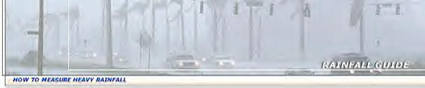
WEATHER IS THE MOST TALKED ABOUT TOPIC IN THE WORLD,
WHETHER YOU'RE COMMENTING ON GOOD WEATHER OR BAD WEATHER. THE
DIFFERENCE IS THAT GOOD WEATHER DOESN'T CAUSE FINANCIAL HARDSHIP, BUT BAD
WEATHER CAN RUIN A NORMALLY SUCCESSFUL FUNCTION OR BUSINESS.
EVERY FILM PROJECT, TV COMMERCIAL EVENT IS AT THE MERCY
OF THE "WEATHER," WITH INSUFFICIENT OR EXCESSIVE WEATHER PERILS SUCH AS:
RAINFALL, SNOWFALL, WIND, TEMPERATURE, LIGHTNING, FOG, CLOUD COVER,
SUNSHINE, AND ICY ROADS CONDITIONS.
THE "WEATHER" IS USUALLY THE ONLY THING THAT YOU CANNOT
CONTROL.
THE RAIN IS THE MOST COMMON PROBLEM ON THE OUTSIDE, BUT
TEMPERATURE, WIND, LIGHTNING, FOG, CEILING HEIGHT, AND VISIBILITY CAN ALSO
PRESENT PROBLEMS.
FOR INDOOR, SNOW IS THE MOST COMMON PROBLEM, BUT
TEMPERATURE, WIND, OR ICY ROAD CONDITIONS CAN ALSO PRESENT PROBLEMS.
THESE "WEATHER PROBLEMS" WILL AFFECT THE
POCKETS OF ALL THE PRODUCERS AND PRODUCTION COMPANIES.
OUR HUMAN WEATHER OBSERVERS CAN FULLY DOCUMENT THE EXACT
WEATHER CONDITIONS, AS IT HAPPENS AND NO ONE CAN QUESTION IT BECAUSE THE
"OBSERVER" IS CONSIDERED THE "OFFICIAL" WEATHER !!
ALL WEATHER OBSERVERS ARE EXTREMELY TRAINED AND FAMILIAR
WITH ALL CONCERNS AND WILL VERIFY ALL WEATHER CONDITIONS, AS IT EXISTS
"ON-THE-SET" !!
COMMON CONCERNS FOR FILMING ARE: EXCESS RAIN,
EXCESS SNOW, WIND, FOG, UNDERWATER VISIBILITY, REASONABLE PHOTOGRAPHIC
CONDITIONS (RPC), LIMITED FILMING CONDITIONS (LFC), SUNSHINE, AND LACK OF
SNOW.
THESE DESCRIPTIONS, BELOW, ARE ONLY PRESENTED AS A SIMPLE
GUIDE, SINCE MANY VARIABLES SUCH AS TERRAIN, DRAINAGE AND INTENSITY CAN
ALTER THE DESCRIPTIONS ----
YOUR RAINFALL GUIDE:
Courtesy of aviationweatherinc.com |
|
0.01"
= |
-
THE FIRST MEASURABLE AMOUNT OF RAINFALL, REPORTED BY THE
NATIONAL WEATHER SERVICE.
-
A LIGHT SHOWER FOR 2-5 MINUTES
-
OR A DRIZZLE FOR 2 HOURS.
EXAMPLE: THIS WOULD NOT LEAVE PUDDLES ON THE GROUND
AND WOULD SLIGHTLY WET THE SURFACE.
|
|
0.10" = |
-
A LIGHT RAIN FOR 30-45 MINUTES,
-
MODERATE RAIN FOR 10 MINUTES,
-
OR HEAVY RAIN FOR 5 FULL MINUTES.
EXAMPLE: SMALL PUDDLES WOULD FORM BUT USUALLY
DISAPPEAR AFTER A SHORT WHILE.
|
|
0.25" = |
-
A LIGHT RAIN FOR 2-3 HOURS,
-
MODERATE RAIN FOR 30-60 MINUTES,
-
OR HEAVY RAIN FOR 15 FULL MINUTES.
EXAMPLE: MANY PUDDLES ON THE GROUND THAT DO NOT
DISAPPEAR EASILY.
|
|
0.50" = |
-
A LIGHT RAIN NEVER REACHES THIS AMOUNT,
-
MODERATE RAIN FOR 1-2 HOURS,
-
OR HEAVY RAIN FOR 30-45 FULL MINUTES.
EXAMPLE: DEEP STANDING WATER FOR LONG PERIODS OF
TIME.
|
|
TOTAL RAINFALL
|
-
THE ACCUMULATED RAINFALL OVER THE INSURED PERIOD, WITHOUT
TAKING INTO ACCOUNT HOW MANY TIMES IT RAINS OVER THAT PERIOD.
ACCORDING TO YOUR WEATHER INSURANCE PROVIDER AND
POLICY.
|
THESE MEASUREMENTS ARE TAKEN WITH A
PRE-APPROVED RAIN GAUGE, OR AN INDEPENDENT WEATHER OBSERVER. (SOME
PROVIDERS ALLOW THE "ASOS" TO BE YOUR "OFFICIAL" WEATHER)
PLEASE NOTE: THE "ASOS" MACHINE
(NOT A HUMAN) COLLECTS YOUR RAINFALL DATA.
-
THE "ASOS" MACHINE IS CONSIDERED THE
"OFFICIAL" WEATHER ON THE LOCATION FOR THE POLICY HOLDER, IF AN
INDEPENDENT WEATHER OBSERVER IS --NOT-- HIRED !!.
-
NWS'S RAINFALL AMOUNTS AT BOTH ON-LOCATION
AND AT AIRPORTS CONTINUE TO HAVE SERIOUS ERRORS AND INACCURACIES FULLY
DOCUMENTED OF UP TO FORTY (40) PERCENT !!
-
THE "WEATHER" AND ITS AIR MASS DOES AFFECT
WHEN COLLECTING MEASUREMENTS !!
-
THE INSURANCE PROVIDERS KNOW OF THESE
INACCURACIES WITH THE 'ASOS" MACHINE !!
-
ALSO, FIND OUT WHERE YOUR "ASOS" MACHINE IS
LOCATED.
-
WHO EXACTLY MAINTAINS IT, CALIBRATES IT, AND
HOW OFTEN !!
-
ASK TO CONTACT "AOMC" TO ASK QUESTIONS
ABOUT ALL "LEVEL THREE" TICKETS ISSUED !!
-
ASK "AOMC" HOW MANY "RAINFALL DATA IN
ERROR" MESSAGES HAVE BEEN DISPLAYED !!
-
ASK HOW MANY "TICKETS" REGARDING RAINFALL
HISTORY HAVE BEEN DOWNGRADED TO "LEVEL THREE" STATUS !!
-
ASK "AOMC" JUST HOW LONG WAS IT "IN
ERROR" BEFORE IT WAS SEEN BY A TECHNICIAN !!
-
WHY WAS IT DOWNGRADED IN THE FIRST PLACE
AND THEN TURNED IMMEDIATELY BACK ON !!
-
YOUR ARE YOU EVEN CONSIDERING USING RAINFALL
DATA, MILES AWAY FROM THE "SET ANYWAY WITH THE "ASOS"MACHINE SURROUNDED BY
AN ELECTRIC 15-FOOT FENCE.
-
IS YOUR "ASOS" MACHINE IN THE MIDDLE OF TALL
TREES, HIDDEN AWAY FROM THE PUBLIC
-
THE "ASOS" AND ITS "SENSORS" ARE LOCATED
BESIDE THE FAA RUNWAY.
-
MOST LOCATIONS ARE DIRECTLY IN FRONT OF THE
"ILS" RUNWAY, OTHERS ARE HIDDEN BEHIND A TALL BUILDING OR AMONG TREES IN
THE MIDDLE OF A PARK !!
-
IS THE "ASOS"IN THE BEST POSSIBLE POSITION
TO COLLECT YOUR RAINFALL AMOUNTS !!
-
THE (NWS) NATIONAL WEATHER SERVICE (NWS) AND
THE FEDERAL AVIATION ADMINISTRATION (FAA) SHARE JOINT RESPONSIBILITY FOR
THE "ASOS" ACCORDING TO CONGRESS !!
-
THE "ASOS" HAS BEEN IN THE CENTER OF
CONTROVERSY WITHIN THE AVIATION COMMUNITY FOR OVER EIGHT (8) YEARS !!
THIS IS FULLY DOCUMENTED FOR ALL TO SEE !!
-
ALL "ASOS" DOCUMENTATION IS TAKEN DIRECTLY FROM THE FAA, NWS, AND
GAO REPORTS, YOU MUST VISIT OUR "ASOS" PAGE. MAKE YOUR OWN
DECISION ABOUT THE "ASOS" MACHINE !!
LEARN ABOUT THE "ASOS" AND HOW IT
COLLECTS RAINFALL DATA !!
(GO TO OUR "ASOS" PAGE)
ASK US ABOUT OUR "ELECTRONIC RAIN GAUGE" (WITH RAIN
DATA EVENT LOGGER)
TO MEASURE THE RAIN OR SNOW FOR FILM PROJECTS, TV COMMERCIALS OR ANY OTHER OUTDOOR EVENT,
WHICH IS INSURED. OUR RENTAL RATE: JUST $100 PER DAY !!
ORDER NOW, AND GET DETAILED RAINFALL HISTORY FOR YOUR SITE !!
CONTACT US DIRECTLY VIA E-MAIL AT: WXCENTER@AVIATIONWEATHERINC.COM
OR WXCENTER@AOL.COM TODAY !!
COPYRIGHT ©
2000-2001. AVIATION WEATHER, INC. ALL RIGHTS RESERVED.
WHERE WEATHER IS THE ISSUE OF FACT, CERTIFIED OR NON-CERTIFIED, PLAIN
LANGUAGE REPORTS, OFFICIAL WEATHER REPORTS, EXPERT WITNESS OR COURT TESTIMONY,
CONSULTATION EITHER BY PHONE OR IN PERSON, DEPOSITIONS, SUNRISE / SUNSET AND MOON
RISE / SET DATA.
YOU WILL FIND OUR SERVICE TO BE FAST, PROFESSIONAL, COURTEOUS AND
REASONABLY PRICED. AS A RESULT OF OUR EXPERTISE, WE ARE ABLE TO PROVIDE YOU WITH
INFORMATION THAT IS RELEVANT TO YOUR CASE, SINCE WE ANTICIPATE ALL YOUR REQUIREMENTS WITH
RESPECT TO THE CONTENT AND FORM OF WEATHER DATA YOU MAY NEED.
YOU WILL NOT HAVE ANY SURPRISES, DISAPPOINTMENTS OR DELAYS IN OUR
FULFILLING YOUR ORDER. IN FACT, WE HAVE BEEN SERVING YOUR PROFESSION FOR MANY YEARS.
ASK US ABOUT OUR "ARCHIVE WEATHER DATA VAULT", TOO !
ASK US ABOUT OUR "ELECTRONIC RAIN GAUGE" (WITH RAIN LOGGER)
TO MEASURE THE RAIN OR SNOW FOR FILM PROJECTS, TV COMMERCIALS OR ANY OTHER OUTDOOR EVENT,
WHICH IS INSURED. OUR RENTAL RATE: JUST $100 PER DAY !!
ORDER NOW, AND GET DETAILED RAINFALL HISTORY FOR YOUR SITE !!
CONTACT US DIRECTLY VIA E-MAIL AT: WXCENTER@AVIATIONWEATHERINC.COM
OR WXCENTER@AOL.COM TODAY !!
COPYRIGHT ©
2000-2001. AVIATION WEATHER, INC. ALL RIGHTS RESERVED.
MAKING IMPORTANT IMPROVEMENTS IN WEATHER NEWS ACCURACY AND
PRESENTATION IS GREATER THAN EVER. YOUR READERS WILL COME TO RELY UPON YOUR
'WEATHER-PAGE'.
OUR FORECASTS, TEXT AND SAMPLE GRAPHIC PRODUCTS ARE DESIGNED TO BE
NOT ONLY ACCURATE, BUT ALSO CLEAR AND EASY-TO-UNDERSTAND.
IMMEDIATELY PRIOR TO YOUR DEADLINE, OUR TEXT PRODUCTS ARE PREPARED
FROM THE LATEST WEATHER INFORMATION WORLDWIDE.
FAXED HARD-COPY, E-MAIL, (VOICEMAIL) OR FAX / MODEM, AS DESIRED.
IT IS THAT SIMPLE.
YOUR WEEKLY INVESTMENT FOR THIS SERVICE WILL ACHIEVE SUBSTANTIAL
IMPROVEMENTS WITHIN A MODEST BUDGET AND DEPENDS PRIMARILY ON WHICH 'PACKAGE' OF LOCAL,
REGIONAL AND WORLDWIDE WEATHER FORECASTS, TEXT AND TABLES YOU REQUEST.
FROM OUR BROADCAST PROFESSIONALS, THERE ARE OVER A DOZEN DIFFERENT
VOICED FEATURES THAT ARE AVAILABLE TO YOU VIA VOICEMAIL OR ISDN FEED .....
-
WEATHER: HOURLY U.S. AND WORLDWIDE
FORECASTS.
-
SPORTS: SCOREBOARD,
BOX SCORES, NEWS & STATS.
-
LOTTERY: ALL STATE RESULTS.
-
SOAPS: DAILY SUMMARIES OF ALL
NETWORK SOAPS.
-
NEWS: LOCAL, NATIONAL AND
INTERNATIONAL.
- HOROSCOPES:
DAILY HOROSCOPES & LUCKY NUMBERS.
- FINANCIAL:
BUSINESS NEWS, STOCKS AND METALS.
"THE WEATHER CENTER,"
A COMPLETE BROADCAST
SERVICE OF AVIATION WEATHER, INC. - CAN ALSO PROVIDE CONSISTENT, UP-TO-DATE INTERNET
CONTENT FOR YOUR WEB-SITE AS WELL !
CONTACT US DIRECTLY VIA E-MAIL AT: WXCENTER@AVIATIONWEATHERINC.COM
OR WXCENTER@AOL.COM TODAY !!
COPYRIGHT ©
2000-2001. AVIATION WEATHER, INC. ALL RIGHTS RESERVED.
WEATHER IS A KEY PART OF A SOLID PROGRAM BASE - NOT 'RIP
& READ' WEATHER FORECASTS. WE HAVE REAL-TIME DOPPLER & NEXRAD RADAR AND
SATELLITE. WE UTILIZE SEVERAL DIFFERENT STATE-OF-THE-ART COMPUTER MODELS, ENABLING
US TO TAILOR WEATHER FORECASTS TO YOUR NEEDS.
YOU WILL ALWAYS REACH A 'LIVE' METEOROLOGIST, NEVER A RECORDING.
USING "THE WEATHER CENTER" FOR YOUR SHOOT IS LIKE HAVING YOUR OWN
CONSULTING METEOROLOGIST ON YOUR 'CALL-SHEET'.
BECAUSE OF THE DIVERSE NEEDS OF THE FILM & VIDEO PRODUCTION
INDUSTRY, WE OFFER SEVERAL DIFFERENT SERVICES .....
-
'PHONE-CONSULTATION': THIS SERVICE
ALLOWS YOU TO GET THE LATEST WEATHER FORECAST OVER THE PHONE, DIRECTLY
FROM OUR PROFESSIONAL METEOROLOGISTS. YOU CAN ASK SPECIFIC QUESTIONS
AND THEN CALL-BACK ANYTIME FOR THE LATEST UPDATE.
-
'WX E-MAIL / WX-FAX': SOMETIMES YOU
NEED DOCUMENTATION OF WHAT THE WEATHER FORECAST IS FOR INSURANCE PURPOSES. OR MAYBE
YOU JUST DON'T HAVE ANY TIME TO SPEND ON THE PHONE WRITING DOWN WHAT THE METEOROLOGISTS
SAYS. IT IS FOR THESE REASONS, THAT WE ALSO OFFER THIS SERVICE. JUST CALL US
WHEN YOU NEED A FORECAST, AND WE'LL HAVE ONE SENT OUT WITHIN A FEW MINUTES OR AT A
SCHEDULED TIME FOR YOUR NEXT-DAY 'CALL-SHEET'.
- 'PHONE CONSULTATION & WX E-MAIL /
WX-FAX': THIS DELUXE PACKAGE OFFERS YOU THE BEST OF BOTH WORLDS. YOU WILL
RECEIVE THE ADVANTAGES OF 'LIVE' PHONE CONSULTATIONS, ALONG WITH THE CONVENIENCE OF A
FAXED HARD-COPY OR E-MAIL FORECAST.
ASK US ABOUT OUR "ELECTRONIC RAIN GAUGE" (WITH RAIN LOGGER)
TO MEASURE THE RAIN OR SNOW FOR FILM PROJECTS, TV COMMERCIALS OR ANY OTHER OUTDOOR EVENT,
WHICH IS INSURED. OUR RENTAL RATE: JUST $100 PER DAY !!
ORDER NOW, AND GET DETAILED RAINFALL HISTORY FOR YOUR SITE !!
LEARN ABOUT THE "ASOS" AND HOW IT
COLLECTS RAINFALL DATA !!
(GO TO OUR "ASOS" PAGE)
CONTACT US DIRECTLY VIA E-MAIL AT: WXCENTER@AVIATIONWEATHERINC.COM
OR WXCENTER@AOL.COM TODAY !!
COPYRIGHT ©
2000-2001. AVIATION WEATHER, INC. ALL RIGHTS RESERVED.
"RAIN GAUGE WITH
RAIN DATA EVENT LOGGER" RENTALS !
ALL RAIN GAUGE RENTALS
INCLUDE
'RAIN DATA LOGGER'
ATTACHMENT.
READING THE WEATHER ...
FOR THE FILM & TV COMMERCIAL
INDUSTRY. RECORD MEASUREMENTS WITH DETAILED RAINFALL HISTORY.
PERFECT FOR 'OUTDOOR SHOOTS' WHICH ARE INSURED BY WEATHER INSURANCE
PROVIDER.
MEASURING PRECIPITATION IS EXTREMELY IMPORTANT. PRECIPITATION
IS OUR SPECIALTY. SO, RENT YOUR "RAIN GAUGE WITH
ATTACHED RAIN DATA LOGGER" FROM
US TODAY !!
AVAILABLE METHODS OF RAIN COLLECTION INCLUDE NATIONAL WEATHER SERVICE
MANUAL RAIN COLLECTORS TO HIGH ACCURACY TIPPING-BUCKET RAIN GAUGES. ALSO
INCLUDED ARE SEVERAL METHODS OF RETRIEVING AND VIEWING GATHERED MEASUREMENTS FOR YOUR
COMPANY.
ALL (RENTAL) GAUGES ARE DESIGNED TO STRICT NATIONAL
WEATHER SERVICE (NWS) CRITERIA AND WEATHER INSURANCE POLICY STANDARDS.
RAIN GAUGES ARE OF SEVERAL TYPES AND MEASURE NOT ONLY THE RAIN BUT
ALL OTHER FORMS OF PRECIPITATION. TIPPING BUCKET GAUGES HAVE A DIVIDED BUCKET
BALANCED SO THAT ONE SIDE FILLS, THEN TIPS ITS WATER INTO A CONTAINER AND ALLOWS THE OTHER
SIDE TO FILL. AS THE BUCKET TIPS, IT SENDS AN ELECTRIC SIGNAL TO A RECORDING UNIT
INSIDE THE WEATHER STATION.
IT IS BEST TO HIRE A SPECIALIZED SURFACE WEATHER TECHNICIAN SUCH AS A
CERTIFIED WEATHER OBSERVER OR METEOROLOGICAL TECHNICIAN (TO MEASURE THE WATER,
WHICH RUNS INTO THE CONTAINER) AS A CHECK ON THE RECORDING'S ACCURACY.
THINGS DO HAPPEN FOR ONE REASON OR ANOTHER. BESIDES 'WEATHER' IS A SERIOUS BUSINESS,
AS YOU KNOW.
ANOTHER TYPE OF RECORDING RAIN GAUGE CONTINUOUSLY WEIGHS THE WATER
AND RECORDS THE WEIGHT DIRECTLY ON A GRAPH AS INCHES OF RAINFALL. "ONE INCH OF
RAINFALL" IS A WAY OF SAYING THAT ON LEVEL GROUND -- A LAYER OF RAIN ONE
INCH DEEP -- WOULD REMAIN IF NONE OF THE WATER RAN OFF OR SEEPED INTO THE GROUND.
OUR TIPPING BUCKET RAIN GAUGE, MODEL 260-2501 (RENTAL)
RAIN GAUGE., IS QUITE POPULAR AMONG BOTH EAST-COAST AND WEST-COAST PRODUCTION
COMPANIES. IT IS CONSTRUCTED OF ALUMINUM AND THE SURFACE IS POWDER COATED
GLOSS WHITE. A VARIETY OF CALIBRATION INTERVALS ARE OFFERED TO YOU, AND ITS
SIMPLICITY OF DESIGN ASSURES TROUBLE-FREE OPERATION, YET PROVIDES THE MOST ACCURATE, SO
FAR TO DATE, OF ALL RAINFALL MEASUREMENTS.
THE TIPPING BUCKET MECHANISM FOR MODEL 260-2501 ACTIVATES A SEALED
REED SWITCH THAT PRODUCES A CONTACT CLOSURE FOR EACH 0.01", 0.25 MM OR 1 MM OF
RAINFALL.
THE GAUGE HAS AN 8" ORIFICE AND IS MANUFACTURED OF POWDER COATED
AND ANODIZED ALUMINUM. THE FUNNEL HAS A SCREEN TO PREVENT DEBRIS FROM ENTERING THE
GAUGE.
IT IS SHIPPED
AS SHOWN BELOW (LEFT) COMPLETE WITH MOUNTING BRACKETS.
$100 PER DAY PLUS
DEPOSIT FROM AVIATIONWEATHERINC.COM !!

PICTURED IS THE 'TIPPING BUCKET RAIN GAUGE' (LEFT) AND
'RAIN DATA LOGGER' ATTACHMENT. YOU MAY VIEW A LARGER PICTURE.
PLEASE CLICK ONTO EITHER THUMBNAIL TO ENLARGE PHOTO.
THE SPECIFICATIONS FOR THIS PARTICULAR (RENTAL) RAIN
GAUGE.
-
RAIN GAUGE MODEL 260-2501:
- SENSOR TYPE: TIPPING BUCKET.
- OUTPUT: 0.1 SECOND SWITCH CLOSURE.
- SWITCH: SEALED REED SWITCH.
- SENSITIVITY: 1 TIP PER 0.01", 1 TIP PER 0.25 MM
OR 1 TIP PER 1 MM.
- ACCURACY: ± 3% 0-6
" / HOUR.
- CONTACT RATING: 3 WATTS, 0.25 AMPS, 175 VDC.
- SIZE: 8" DIAMETER X 15" HEIGHT.
- MOUNTING : 3 LEGS, 1/4" DIAMETER BOLT HOLES ON
9 1/2" DIAMETER BOLT CIRCLE.
- WEIGHT / SHIPPING: 6 LBS. / 8 LBS.
NEXT, THE RAIN LOGGER, MODEL 260-2101 IS AN INEXPENSIVE
EVENT DATA LOGGER THAT CONNECTS TO STANDARD TIPPING BUCKET RAIN GAUGES TO PROVIDE DETAILED
RAINFALL HISTORY. THE DATA CAN BE USEFUL IN A WIDE RANGE OF FIELDS SUCH AS
AGRICULTURE, FORESTRY, HYDROLOGY, AND CLIMATOLOGY, TO SAY THE LEAST.
THIS COMPACT UNIT IS IN A WEATHERPROOF CASE. IT RECORDS
THE ACTUAL DATE AND TIME OF EACH BUCKET TIP, ALONG WITH THE ACCUMULATED TOTALS.
MANUAL RECORDING OF RAIN GAUGE DATA IS TOTALLY ELIMINATED BY THE CONVENIENT "RAIN
DATA LOGGER" RENTAL UNIT, SAVING TIME AND ENSURING THAT CRITICAL READINGS ARE
-NOT- MISSED. THE DATA IS STORED IN NONVOLATILE EEPROM MEMORY THAT
RETAINS COLLECTED DATA, EVEN IF THE BATTERY FAILS !!
THE 8000 TIP / EVENT CAPACITY CAN RECORD UP TO 80" OF RAINFALL
BETWEEN READOUTS AT 0.01" PER TIP. A RED LIGHT BLINKS EVERY TWO SECONDS
WHEN THE UNIT IS LOGGING. EACH TIP / EVENT IS LOGGED WITH RESOLUTION DOWN TO 0.5
SECOND. A LITHIUM BATTERY PROVIDES APPROXIMATELY ONE YEAR OF CONTINUOUS USE
AND IS EASILY REPLACED BY THE USER. THE "RAIN LOGGER" RENTAL UNIT
CAN BE MOUNTED INSIDE OR OUTSIDE THE RAIN GAUGE HOUSING, BUT IT MUST AVOID DIRECT
SUNLIGHT OR IT WILL NOT WORK PROPERLY.
NEXT, THE SPECIFICATIONS FOR THE "RAIN
DATA LOGGER" INCLUDED IN
(RENTAL) UNIT.
-
RAIN DATA LOGGER MODEL 260-2101:
- EVENT TYPE: RELAY CONTACT OPENING (RAIN GAUGE TIP).
- EVENT RESOLUTION: 0.5 SECONDS.
- MINIMUM EVENT DURATION: 20 MICROSECONDS.
- OPERATING TEMPERATURE: -20°
TO +70° CELSIUS (-4°
TO +158° FAHRENHEIT)
- TIMEKEEPING ACCURACY: ±
1 MINUTE PER WEEK AT 20° CELSIUS.
- CAPACITY: 8000 EVENTS.
- BATTERY: CR-2032 LITHIUM.
- CASE: NEMA-TYPE WEATHERPROOF ENCLOSURE.
- WEIGHT / SHIPPING: 3.3 OZ. / 1 LB.
- YEAR 2000 COMPLIANT.
THE SOFTWARE LOCATED AT OUR WEATHER OFFICE, ALLOWS US
(CERTAINLY, NOT AT THE INSURANCE COMPANY'S OFFICE) TO INDEPENDENTLY READOUT THE
RECORDED DATA AFTER THE EVENT, VIEW IT IN TABULAR AND GRAPHICAL FORMATS, OR EXPORT
IT FOR USE WITH OTHER PROGRAMS.
THE COLLECTED RAINFALL HISTORY DATA INCLUDES DATE AND TIME STAMP,
PLUS THE LOGGER'S START AND STOP TIMES. THE SOFTWARE ALSO SYNCHRONIZES LOGGER AND
DATA TRANSFER UNIT CLOCKS TO COMPUTER CLOCK AND CHECKS BATTERY STATUS, IF WEATHER
TECHNICIAN IS LOCATED "ON THE SET" FOR IMMEDIATE VERIFICATION.
THE MOST IMPORTANT FEATURE OF THIS SERVICE IS THAT WE ARE INDEPENDENT
FROM THE INSURANCE COMPANY AND THAT WE ARE AVAILABLE TO FULLY ASSIST YOU IN THE
PREPARATION AND CONSTANT MONITORING OF SUCH EQUIPMENT, IF NEED BE.
REMEMBER -- YOU BUY THE POLICY -- THEN YOU
HIRE US TO MONITOR IT FOR YOU !! WE WORK FOR YOU AND ONLY YOU !!
FOR ONLY $100 PER DAY (WITH A SECURITY DEPOSIT OF $500
DOLLARS) -- THIS ARRANGEMENT WILL PROPERLY SECURE THE EQUIPMENT TO BE
DELIVERED 'OVERNIGHT' VIA U.P.S. TO YOUR DESIRED LOCATION !!
PLEASE NOTE: CERTIFIED WEATHER OBSERVERS OR
METEOROLOGICAL TECHNICIANS ARE EXTRA, NOT INCLUDED IN RENTAL FEE OF $100 DOLLARS PER DAY,
AND WILL BE PAID PRIOR TO THE ACTUAL SHOOT, IF HIRED BY YOU OR THE PRODUCER
(FOR "SETUP" AND "MONITORING OF WEATHER") OF THE FILM OR TV
COMMERCIAL PRODUCTION COMPANY.
REFER TO OUR 'PRODUCTS' PAGE (LISTED AT TOP OF THIS SITE)
FOR OTHER DETAILS AND MORE INFORMATION.
LEARN ABOUT THE "ASOS" AND HOW IT
COLLECTS RAINFALL DATA !!
(GO TO OUR "ASOS" PAGE)
CONTACT US DIRECTLY VIA E-MAIL AT: WXCENTER@AVIATIONWEATHERINC.COM
OR WXCENTER@AOL.COM TODAY !!
COPYRIGHT ©
2000-2001. AVIATION WEATHER, INC. ALL RIGHTS RESERVED.
"THE WEATHER CENTER" CAN PROVIDE YOU WITH
INFORMATION ABOUT TIDES AND ALSO ACCURATELY FORECAST WINDS AND WAVE CONDITIONS ON ANY BODY
OF WATER.
CONTACT US DIRECTLY VIA E-MAIL AT: WXCENTER@AVIATIONWEATHERINC.COM
OR WXCENTER@AOL.COM TODAY !!
COPYRIGHT ©
2000-2001. AVIATION WEATHER, INC. ALL RIGHTS RESERVED.
WE CAN ALSO SEARCH OUR "ARCHIVE WEATHER DATA VAULT" TO GIVE
YOU CLIMATE INFORMATION ABOUT YOUR SITES. A TYPICAL CLIMATE STUDY WILL GIVE YOU
INFORMATION ON HOW MUCH WIND, CLOUD COVER, AND PRECIPITATION USUALLY OCCURS FOR A GIVEN
TIME OF YEAR, AS WELL AS DAILY TEMPERATURE NORMALS AND EXTREMES.
CONTACT US DIRECTLY VIA E-MAIL AT: WXCENTER@AVIATIONWEATHERINC.COM
OR WXCENTER@AOL.COM TODAY !!
COPYRIGHT ©
2000-2001. AVIATION WEATHER, INC. ALL RIGHTS RESERVED.
"THE WEATHER CENTER" PROVIDES
A VARIETY OF FORECAST AND WARNING SERVICES FOR LOCAL GOVERNMENTS, PORT AUTHORITIES AND
SCHOOLS. THIS INCLUDES DETAILED FORECASTS OF PRECIPITATION TIMES, AS WELL AS
ADVANCE WARNING OF EXPECTED HIGH WINDS, THUNDERSTORMS OR WINTER
PRECIPITATION.
OUR METEOROLOGISTS ARE AT WORK 24 HOURS PER DAY TRACKING POTENTIALLY
DANGEROUS WEATHER AND PROVIDING DETAILED FORECASTS AND ADVISORIES SPECIFICALLY TAILORED
FOR YOUR INDIVIDUAL LOCATION.
CONTACT US DIRECTLY VIA E-MAIL AT: WXCENTER@AVIATIONWEATHERINC.COM
OR WXCENTER@AOL.COM TODAY !!
COPYRIGHT ©
2000-2001. AVIATION WEATHER, INC. ALL RIGHTS RESERVED.
AVIATION WEATHER, INC. PROVIDES
PROFESSIONALLY TRAINED METEOROLOGISTS WITH ACCESS TO OUR WORLDWIDE WEATHER DATABASE TO
PREPARE AND DELIVER CUSTOM BRIEFINGS SPECIALIZING TO THE AVIATION COMMUNITY WITH A
DEDICATED TEAM OF FLIGHT COORDINATORS WHO MANAGE YOUR ENTIRE TRIP FROM DEPARTURE TO
ARRIVAL, 24 HOURS PER DAY.
OUR FLIGHT DISPATCHERS HOLDING THE GOVERNMENT-ISSUED LICENSE ARE
CAPABLE OF PROVIDING YOU WITH THE FLIGHT RELEASE ACCORDING TO THE PARTICULARS OF EACH
FLIGHT.
AVIATION WEATHER, INC. WILL CENTRALLY COORDINATE
EVERY SERVICE YOU NEED FROM FLIGHT PLANNING, WEATHER BRIEFINGS, OVERNIGHT PERMITS, FUEL
AND SLOTS, TO HOTEL RESERVATIONS, GROUND TRANSPORTATION, CATERING, VISAS, SECURITY AND
MORE.
AVIATION WEATHER, INC. ALSO PERFORMS CONTRACT
WEATHER OBSERVATIONS (INCLUDING THE NEEDED METAR PREPARATION AND SOME OFFICIAL TRAINING)
WHICH CONSISTS OF DATA THAT FOLLOWS STRICT GUIDELINES SET FORTH BY THE NATIONAL WEATHER
SERVICE (NWS) AND THE FEDERAL AVIATION ADMINISTRATION (FAA).
CONTACT US DIRECTLY VIA E-MAIL AT: WXCENTER@AVIATIONWEATHERINC.COM
OR WXCENTER@AOL.COM TODAY !!
COPYRIGHT ©
2000-2001. AVIATION WEATHER, INC. ALL RIGHTS RESERVED.
FLIGHT PLANNERS WITH GLOBAL EXPERTISE BUILD, RUN, AND FILE FLIGHT
PLANS TAILORED TO YOUR AIRCRAFT AND COMPANY PREFERENCES 24 HOURS PER DAY. ALL OVER
THE WORLD.
CONTACT US DIRECTLY VIA E-MAIL AT: WXCENTER@AVIATIONWEATHERINC.COM
OR WXCENTER@AOL.COM TODAY !!
COPYRIGHT ©
2000-2001. AVIATION WEATHER, INC. ALL RIGHTS RESERVED.
THE FLIGHT RELEASE WILL BE SIGNED UPON THE FLIGHT PLAN DRAWN BY OUR
DISPATCHERS, BUT MAY AS WELL BE BASED ON THE FLIGHT PLAN TRANSMITTED TO PILOTS FROM THEIR
HOME BASE.
CONTACT US DIRECTLY VIA E-MAIL AT: WXCENTER@AVIATIONWEATHERINC.COM
OR WXCENTER@AOL.COM TODAY !!
COPYRIGHT ©
2000-2001. AVIATION WEATHER, INC. ALL RIGHTS RESERVED.
COMPUTER-BASED WEATHER BRIEFING BY OUR FLIGHT DISPATCHER WILL UPDATE
AND UPGRADE THE OFFICIAL WEATHER DOCUMENTS AND / OR DOCUMENTS RECEIVED FROM THE PILOT'S
HOME BASE ON THE SPOT JUST PRIOR TO DEPARTURE, THIS WILL GREATLY HELP ENHANCING THE
OVERALL FLIGHT SAFETY.
CONTACT US DIRECTLY VIA E-MAIL AT: WXCENTER@AVIATIONWEATHERINC.COM
OR WXCENTER@AOL.COM TODAY !!
COPYRIGHT ©
2000-2001. AVIATION WEATHER, INC. ALL RIGHTS RESERVED.
A COMPLETE SET OF WEATHER DOCUMENTS, RETRIEVABLE FROM THE DATABASE OF
OUR GLOBAL ENVIRONMENTAL SYSTEM, CAN BE TAILORED TO EACH PILOT'S SPECIFIC REQUIREMENTS.
OUR CUSTOMIZED SERVICE PROVIDES THE PILOTS WITH EXACTLY THE DOCUMENTS
HE NEEDS FOR HIS SAFETY, THUS AVOIDING THE CONFUSION OF TOO MANY DIFFERENT DOCUMENTS.
CONTACT US DIRECTLY VIA E-MAIL AT: WXCENTER@AVIATIONWEATHERINC.COM
OR WXCENTER@AOL.COM TODAY !!
COPYRIGHT ©
2000-2001. AVIATION WEATHER, INC. ALL RIGHTS RESERVED.
VISUAL PRESENTATION OF THE EXPECTED WEATHER PHENOMENA ALONG THE
PLANNED ROUTE AND IN THE TERMINAL AREAS OF BOTH DEPARTING AND LANDING POINTS ASSISTING THE
PILOT TO UNDERSTAND AND PLOT HIS FORTHCOMING FLIGHT.
CONTACT US DIRECTLY VIA E-MAIL AT: WXCENTER@AVIATIONWEATHERINC.COM
OR WXCENTER@AOL.COM TODAY !!
COPYRIGHT ©
2000-2001. AVIATION WEATHER, INC. ALL RIGHTS RESERVED.
AVIATION WEATHER, INC. WILL DISPLAY ALL NOTAM
INFORMATION AND CAN PRODUCE PRINTS OF NOTAMS' SUMMARIES FOR ALL FLIGHT CREW INVOLVED.
CONTACT US DIRECTLY VIA E-MAIL AT: WXCENTER@AVIATIONWEATHERINC.COM
OR WXCENTER@AOL.COM TODAY !!
COPYRIGHT ©
2000-2001. AVIATION WEATHER, INC. ALL RIGHTS RESERVED.
(BACK
TO TOP)
WE MONITOR THE FLIGHT PROGRESS AND ADVISE THE PILOTS OF CHANGES IN
WEATHER ENROUTE, THE DESTINATION AND THE SELECTED ALTERNATE AERODROMES. IF
NECESSARY, WE WILL RECOMMEND NEW DESTINATIONS AND / OR ALTERNATES.
FLIGHT FOLLOW-UP, REPLANNING AND REDISPATCH WILL BE PERFORMED UPON
REQUEST OF THE OPERATORS.
DURING CRITICAL WEATHER, THE PILOT WILL BE KEPT INFORMED OF THE
CURRENT AND EXPECTED DEVELOPMENT THROUGH THE COMPANY'S VHF RADIO WHILE THE AIRCRAFT IS IN
THE TERMINAL AREA.
UP-TO-THE-MINUTE DEPARTURE, ENROUTE, AND ARRIVAL INFORMATION IS
PROCESSED AND TRANSMITTED BY OUR 24-HOUR FLIGHT FOLLOWING TEAM. IT'S THE
COMMUNICATIONS HUB THAT KEEPS YOUR HOME OFFICE, DESTINATION HANDLERS, AND CUSTOMS &
IMMIGRATION INFORMED ABOUT YOUR AIRCRAFT'S MOVEMENT.
CONTACT US DIRECTLY VIA E-MAIL AT: WXCENTER@AVIATIONWEATHERINC.COM
OR WXCENTER@AOL.COM TODAY !!
COPYRIGHT ©
2000-2001. AVIATION WEATHER, INC. ALL RIGHTS RESERVED.
AVIATION WEATHER, INC. DELIVERS QUALITY GROUND
HANDLING SERVICES AT EVERY STOP YOU MAKE AT LOCATIONS SERVED BY OUR EVER-EXPANDING
WORLDWIDE SERVICE NETWORK.
CONTACT US DIRECTLY VIA E-MAIL AT: WXCENTER@AVIATIONWEATHERINC.COM
OR WXCENTER@AOL.COM TODAY !!
COPYRIGHT ©
2000-2001. AVIATION WEATHER, INC. ALL RIGHTS RESERVED.
WE ESTABLISH
LIAISON WITH CREW HOME BASE. WE TAKE CARE OF
ACCOMMODATION AND TRANSPORTATION PLUS SUPPLY OPERATIONAL INFORMATION TO THE CREW.
CONTACT US DIRECTLY VIA E-MAIL AT: WXCENTER@AVIATIONWEATHERINC.COM
OR WXCENTER@AOL.COM TODAY !!
COPYRIGHT ©
2000-2001. AVIATION WEATHER, INC. ALL RIGHTS RESERVED.
OUR AVIATION WEATHER FLIGHT SAFETY & SUPPORT SERVICES DEPARTMENT
INCLUDES COORDINATION WITH THE CARRIER'S STATION DEALING WITH THE WEIGHT & BALANCE
CONTROL. WE ALSO COMMUNICATE WITH THE CARRIER'S STATION MECHANIC CONCERNING AIRCRAFT
STATUS AND REPORT ANY PREDICTABLE WEATHER OCCURRENCES WHICH MAY AFFECT AIRCRAFT AND
MAINTENANCE WORK.
DIRECT CONTACT WITH THE CARRIER'S PASSENGER SERVICE FOR A GENERAL
WEATHER ADVISORY TO PASSENGERS IS AN INTEGRATED FEATURE OF OUR SERVICES.
CONTACT US DIRECTLY VIA E-MAIL AT: WXCENTER@AVIATIONWEATHERINC.COM
OR WXCENTER@AOL.COM TODAY !!
COPYRIGHT ©
2000-2001. AVIATION WEATHER, INC. ALL RIGHTS RESERVED.
HERE IN THIS SECTION, WE PROVIDE INFORMATION THAT IS USEFUL TO ANYONE
WHO HAS QUESTIONS ABOUT WEATHER OBSERVATIONS, HOW THEY ARE CONDUCTED, WHY WE NEED THEM AND
HOW YOU CAN GET INVOLVED.
WEATHER OBSERVATIONS ARE TAKEN AT LEAST ONCE AN HOUR AT ALMOST EVERY
AIRPORT THROUGHOUT THE UNITED STATES INCLUDING HAWAII AND ALASKA. WEATHER
OBSERVATIONS CONSIST OF DATA THAT FOLLOWS STRICT GUIDELINES SET FORTH BY THE NATIONAL
WEATHER SERVICE (NWS).
THIS DATA INCLUDES BUT IS NOT LIMITED TO WIND-SPEED, CLOUD-HEIGHT,
CLOUD-COVER, TEMPERATURE, AMOUNT OF RAINFALL IN THE LAST HOUR, AND ALSO SIGNIFICANT
REMARKS THAT MAY INCLUDE LIGHTNING, THUNDERSTORMS, AND TORNADIC ACTIVITY. AFTER AN
OBSERVATION IS TAKEN IT IS SENT TO A CENTRAL NETWORK WHERE IT IS DISPERSED NATIONWIDE.
THESE OBSERVATIONS CAN BE SEEN BY ANYONE IN THE AVIATION COMMUNITY AND ARE HEAVILY
RELIED UPON BY FORECASTERS, AIR TRAFFIC CONTROLLERS, AND EVEN LOCAL TELEVISION
PERSONALITIES.
BECAUSE THE FEDERAL AVIATION ADMINISTRATION'S (FAA) NUMBER ONE
CONCERN IS SAFETY, THEY INTENSELY UTILIZE THE NETWORK OF OBSERVATIONS TO GET AN AIRCRAFT
FROM IT'S ORIGIN TO IT'S DESTINATION, SAFELY.
A GOOD WAY OF DOING THIS IS TO READ THE OBSERVATION(S) THAT ARE IN
DIRECT LINE OF THE FLIGHT PATH. IF THE ORIGIN AND DESTINATION AIRPORTS ARE REPORTING
FAIR SKIES (CLEAR), BUT AN AIRPORT ALONG THE WAY IS REPORTING A SUPER CELL THUNDERSTORM --
THE FAA CAN USE THIS INFORMATION AND GUIDE THE PILOT SAFELY AROUND THE
THUNDERSTORM.
THE FAA AND NWS ARE THE GOVERNMENT ENTITIES THAT BID OUT THE WEATHER
OBSERVATION CONTRACTS. BASICALLY WHEN A CONTRACT SOLICITATION IS SENT TO A COMPANY,
THE FAA / NWS IS LOOKING TO STAFF THAT PARTICULAR WEATHER OBSERVATION SITE. WHAT A
COMPANY DOES IS CALCULATE HOW MUCH IT WILL COST FOR THEM TO OFFER SUCH SERVICES TO THE FAA
/ NWS.
AT THIS POINT THE FAA / NWS TAKES A LOOK AT ALL THE BIDS THAT WERE
SENT IN BY ALL QUALIFIED COMPANIES AND AWARD THE CONTRACT BASED ON PRICE,
PAST-PERFORMANCE, AND FINANCIAL STABILITY. WHEN A COMPANY HAS WON A WEATHER
OBSERVATION CONTRACT -- THEY ARE USUALLY NOTIFIED WITHIN 7 DAYS AFTER THE DECISION HAS
BEEN MADE.
NOW, THAT THE COMPANY HAS BEEN AWARDED THE WEATHER OBSERVATION
CONTRACT -- IT IS THE COMPANY'S RESPONSIBILITY TO STAFF THE WEATHER OBSERVATION SITE
ACCORDING TO CONTRACT AND FEDERAL REGULATIONS. FOR EXAMPLE, IF A COMPANY WINS A
24-HOUR SITE THEY MUST LOOK FOR ENOUGH QUALIFIED PERSONNEL TO STAFF THE SITE ON A
CONTINUOUS BASIS.
THIS IS WHERE AVIATION WEATHER, INC. COMES IN. OUR WEATHER
COMPANY HAS MANAGED TO BE PLACED ON EVERY QUALIFIED VENDORS LIST (QVL) FOR EACH RESPECTIVE
FAA REGION. AS SUCH, WE RECEIVE ALL CONTRACT ANNOUNCEMENTS THAT DEAL WITH WEATHER
OBSERVATIONS. IT IS THIS REASON THAT WE POST CURRENT / UPCOMING OPPORTUNITIES ON THE
EMPLOYMENT SECTION OF THIS SITE.
WE WANT TO STAFF OUR CONTRACTS WITH THE BEST PEOPLE AVAILABLE AND TO
DO THAT -- WE NEED A POOL OF RESUMES TO DRAW FROM. SO, IF YOU ARE INTERESTED IN
BECOMING A WEATHER OBSERVER, OR IF YOU ALREADY ARE A CERTIFIED WEATHER OBSERVER, AND WOULD
LIKE TO BE CONSIDERED FOR ANY UPCOMING OPPORTUNITIES -- JUST CONTACT US AT: WXCENTER@AOL.COM OR WXCENTER@AVIATIOMNWEATHERINC.COM
TODAY !!
COPYRIGHT ©
2000-2001. AVIATION WEATHER, INC. ALL RIGHTS RESERVED.
WELCOME TO THE AVIATION WEATHER, INC. EMPLOYMENT SECTION. HERE
YOU WILL FIND CURRENT AND UPCOMING (SITES WHICH SOLICITATIONS HAVE BEEN ISSUED FOR)
EMPLOYMENT OPPORTUNITIES WITH OUR COMPANY.
FOR THE MOST UP-TO-DATE INFORMATION -- BE SURE TO CHECK THIS AREA
OFTEN ! ALL OF THE FOLLOWING POSITIONS ARE FOR WEATHER OBSERVATION SERVICES WHICH
REQUIRE A NATIONAL WEATHER SERVICE CERTIFICATION AND AUTOMATED SURFACE OBSERVING SYSTEM
(ASOS) EXPERIENCE .
WE ARE ALWAYS ACCEPTING RESUMES FROM QUALIFIED CANDIDATES -- NO
MATTER HOW FAR OFF AN UPCOMING OPPORTUNITY IS. JUST E-MAIL US: WXCENTER@AOL.COM WITH YOUR RESUME AND THE
LOCATION(S) YOU ARE INTERESTED IN..
TO BE QUALIFIED FOR ANY OF THE FOLLOWING POSITIONS -- YOU MUST HAVE A
MINIMUM OF SIX (6) MONTHS EXPERIENCE TAKING WEATHER OBSERVATIONS. YOU MUST
ALSO HOLD A CURRENT (NWS) CERTIFICATION OR HAVE BEEN PREVIOUSLY (NWS) CERTIFIED.
| CURRENT EMPLOYMENT OPPORTUNITIES
WITH US: |
| STATUS: |
SITE: |
START DATE: |
|
ALREADY HIRED. |
|
|
|
UPCOMING WEATHER EMPLOYMENT OPPORTUNITIES: |
| STATUS: |
SITE: |
START DATE: |
|
WILL
ADVISE. STAY TUNED. |
|
AVIATION WEATHER, INC. IS AN EQUAL OPPORTUNITY / AFFIRMATIVE ACTION
EMPLOYER. EMPLOYMENT DECISIONS ARE MADE WITHOUT REGARD TO SEX, SEXUAL ORIENTATION,
RACE, RELIGION, COLOR, NATIONAL ORIGIN, AGE, ANCESTRY, DISABILITY, MARITAL STATUS, OR
STATUS AS A SPECIAL DISABLED OR VIETNAM ERA VETERAN.
COPYRIGHT ©
2000-2001. AVIATION WEATHER, INC. ALL RIGHTS RESERVED.
(BACK
TO TOP)
'METAR' OBSERVATION
TRAINING FOR YOU !
START YOUR METEOROLOGICAL
AERODROME REPORT (METAR) TRAINING NOW !!
READING THE WEATHER ...
FOR THE ASPIRING AVIATION
WEATHER OBSERVER AS TAUGHT BY AVIATION WEATHER, INC. EXTRA HANDBOOK(S)
MAY BE ORDERED SEPARATELY, WHILE SUPPLIES LAST.
AVIATION WEATHER OBSERVER (AWO) INDEPENDENT SELF-STUDY COURSE.
AVIATION WEATHER OBSERVERS (AWO'S) ARE NEEDED NATIONWIDE. IN
RECENT YEARS, THE NATIONAL WEATHER SERVICE (NWS) HAS CLOSED OVER HALF OF ITS (NWS) OFFICES
ACROSS THE COUNTRY. DURING THESE MODERNIZATION CHANGES -- THEY IMPLEMENTED THE
AUTOMATED SURFACE OBSERVATION SYSTEM (ASOS) TO PROVIDE WEATHER OBSERVATIONS AT LOCATIONS
WHERE (NWS) OFFICES CLOSED, AND MANY OTHER AIRPORT SITES TO HELP PROVIDE BETTER COVERAGE.
THE FEDERAL AVIATION ADMINISTRATION (FAA) HAS SINCE TAKEN OVER THIS
AMBITIOUS PROJECT AFTER RECOGNIZING POTENTIAL HAZARD TO AVIATION DUE TO THE MANY
LIMITATIONS OF THE 'ASOS' SYSTEM. THUS, THE 'AWO' CAREER WAS BORN.
THE 'FAA' PROVIDES STAFFING OF THESE LOCATIONS THROUGH PRIVATE
CONTRACT WEATHER COMPANIES LIKE US, WHO ARE REQUIRED TO HIRE INDIVIDUALS TRAINED IN TAKING
METEOROLOGICAL AVIATION ROUTINE (METAR) WEATHER OBSERVATIONS. MIND YOU, THIS
REQUIREMENT HAS CREATED AN ON-GOING DEMAND FOR QUALIFIED INDIVIDUALS WITH SPECIALIZED
'METAR' TRAINING.
AVIATION WEATHER, INC.'S INSTITUTE OF VOCATIONAL METEOROLOGY IS
SECOND TO NONE, AND IS ONE OF ONLY A FEW SELECT SCHOOLS IN THE COUNTRY THAT PROVIDES THIS
TYPE OF HIGHLY SPECIALIZED TRAINING TO PEOPLE FROM ALL WALKS OF LIFE. OUR COURSE
DEVELOPERS AND VOCATIONAL TRAINING STAFF ARE FROM 'NWS' AND MILITARY METEOROLOGY
BACKGROUNDS, AND ARE ALL 'AWO' (NWS) CERTIFIED. THIS BACKGROUND OF EXPERIENCE
INCLUDES PROFESSIONAL CAREERS IN OPERATIONAL WEATHER ACROSS THE COUNTRY, AND AROUND THE
WORLD.
NATURALLY, WE KNOW
EXACTLY WHAT IT TAKES TO BECOME A FULLY-QUALIFIED
'AWO'. BECAUSE OF THIS, WE DON'T BOG YOU DOWN WITH MATERIAL OR COURSE WORK THAT YOU
DON'T REALLY NEED OR WILL NEVER USE. OUR SOLE OBJECTIVE IS TO PREPARE YOU FOR
NATIONAL WEATHER SERVICE CERTIFICATION AND A NEW, REWARDING CAREER IN AVIATION WEATHER !
SOME OF THE HIGHLIGHTS OF OUR 'AWO' COURSE INCLUDE:
- A COMPREHENSIVE TRAINING MANUAL ON EVALUATING AND REPORTING
ALL WEATHER ELEMENTS AND REMARKS ASSOCIATED WITH 'METAR' REPORTING STANDARDS
- YOUR OWN COPY OF THE 'NWS' FEDERAL METEOROLOGICAL HANDBOOK
NO.1 (FMH-1) WITH STUDY / REVIEW GUIDE AND QUESTION / ANSWER GUIDE.
A COURSE OF STUDY THAT IS EASY TO FOLLOW AND UNDERSTAND. THE
AVERAGE TURN-AROUND TIME OF THIS QUICK-STUDY PROGRAM IS ONLY 4 WEEKS, BUT YOU ARE ALLOWED
TO FINISH AT YOUR OWN PACE. REGARDLESS OF YOUR PACE, HOWEVER, YOU WILL BE ABLE TO
FINISH IN A FRACTION OF THE TIME REQUIRED BY ANY COMPARABLE COURSES AND AT ABOUT HALF
(1/2) THE COST.
EASY TO FOLLOW STUDY MATERIALS THAT INCLUDE WEIGHTED PRACTICE TESTS
AND ANSWER KEYS THAT FOCUS ON 'NWS' CERTIFICATION CRITERIA.
AN END OF COURSE FINAL EXAM THAT ACCURATELY MEASURES YOUR SKILL LEVEL
AND 'NWS' CERTIFICATION READINESS. YOU WILL KNOW EXACTLY WHERE YOU STAND AND WHAT TO
EXPECT ON YOUR 'NWS' CERTIFICATION EXAM. YOU'RE ASSURED THE PASSING EDGE FOR 'NWS'
CERTIFICATION !
ONLY $350.00 US DOLLARS COMPLETE -- GUARANTEED !!! E-MAIL
US: WXCENTER@AOL.COM NOW!
$350 FROM
AVIATIONWEATHERINC.COM !!
HERE ARE SOME FREQUENTLY ASKED QUESTIONS (FAQ'S):
- QUESTION: WHAT IS AN AVIATION WEATHER OBSERVER (AWO) ?
ANSWER: AN 'AWO' IS AN INDIVIDUAL WHO HOLDS A VALID
NATIONAL WEATHER SERVICE (NWS) METAR (METEOROLOGICAL AVIATION ROUTINE) WEATHER OBSERVATION
CERTIFICATION, AND IS AN EMPLOYEE OF A SPECIALIZED, PRIVATE FAA CONTRACT COMPANY.
- QUESTION: WHERE DO 'AWO'S' WORK AND WHAT DO THEY DO ?
ANSWER: 'AWO'S' WORK AT AIRPORT WEATHER OBSERVING OFFICES
AND ARE ASSIGNED TO MONITOR THE AUTOMATED SURFACE OBSERVATION SYSTEM (ASOS) TO ENSURE THAT
THE INFORMATION REPORTED BY THIS SYSTEM REFLECTS LOCAL WEATHER CONDITIONS AS OBSERVED.
- QUESTION: HOW MUCH DO 'AWO'S' EARN ?
ANSWER: PAY SCALES DO VARY
A LITTLE BIT, BUT STARTING
SALARIES AVERAGE AROUND $30,000 A YEAR. ADDITIONAL BENEFITS INCLUDE PAID VACATION
TIME, HEALTH INSURANCE AND RETIREMENT PLANS.
- QUESTION: COURSE ADMISSION REQUIREMENTS ?
ANSWER: YOU MUST BE 18 YEARS OF AGE OR OLDER TO ENROLL IN
THIS COURSE. THERE IS NO PREVIOUS EXPERIENCE NECESSARY, BUT YOU MUST HAVE AT LEAST A
HIGH SCHOOL DIPLOMA OR EQUIVALENT (GED) AND BE ABLE TO READ, SPEAK AND UNDERSTAND THE
ENGLISH LANGUAGE
CLICK HERE FOR A
COMPLETE LISTING OF NATIONAL 'ASOS' LOCATIONS !
OUR ENROLLMENT GUARANTEE / PLEDGE --
OUR GOAL IS TO PROVIDE PERSONS INTERESTED IN WEATHER-RELATED STUDY
MATERIALS THE MOST ECONOMICAL AND COMPREHENSIVE PROGRAMS AVAILABLE ANYWHERE ! BY
MAKING OUR PROGRAMS SO AFFORDABLE, VIRTUALLY ANYONE INTERESTED IN ORDERING CAN ENJOY THESE
BENEFITS TODAY !
THE AVIATION WEATHER OBSERVER (AWO) INDEPENDENT SELF-STUDY COURSE IS
ONLY $350.00 US DOLLARS COMPLETE, AND COMES WITH ALL THE KNOWLEDGE YOU NEED TO BE READY TO
PASS THE (NWS) TEST !
WHETHER YOU ARE LOOKING TO MAKE THAT ALL IMPORTANT FIRST STEP TOWARD
A NEW, MORE REWARDING CAREER OR ARE SEEKING TO INCREASE YOUR KNOWLEDGE AND SKILLS RELATED
TO VOCATIONAL METEOROLOGY -- WE MAKE IT EASY FOR YOU TO GET STARTED !
ONLY $350.00 US DOLLARS COMPLETE -- GUARANTEED !!! E-MAIL
US: WXCENTER@AOL.COM NOW!
REFER TO OUR 'PRODUCTS' PAGE (LISTED AT TOP OF THIS SITE)
FOR ACTUAL SCHEDULING, BOOKING OF AUDITION, INCLUDING
OTHER DETAILS OR INFORMATION.
LEARN ABOUT THE "ASOS" AND HOW IT WORKS
!!
(GO TO OUR "ASOS" PAGE)
CONTACT US DIRECTLY VIA E-MAIL AT: WXCENTER@AVIATIONWEATHERINC.COM
OR WXCENTER@AOL.COM TODAY !!
COPYRIGHT ©
2000-2001. AVIATION WEATHER, INC. ALL RIGHTS RESERVED.
(BACK
TO TOP)
(GO TO PRODUCTS PAGE)
(BUY
FROM ONLINE STORE)
"WEATHER DATA
BROKER" TRAINING FOR YOU !
EARN MONEY. START
YOUR TRAINING TODAY !!
READING THE WEATHER ...
FOR THE ASPIRING 'WEATHER
DATA BROKER' AS TAUGHT BY AVIATION WEATHER, INC., WHILE SUPPLIES LAST
!!
BECOME A 'WEATHER DATA BROKER -- EARN $1000'S OF DOLLARS AS A
'WEATHER DATA BROKER' !
EVER WONDER HOW INSURANCE COMPANIES PROTECT THEMSELVES FROM BOGUS
WEATHER-RELATED DAMAGE CLAIMS ? OR HOW ENGINEERS ARE ABLE TO HELP BUILDERS
RECONSTRUCT EVENTS THAT LED TO THE COLLAPSE OR DAMAGE OF A BUILDING RELATED TO A WEATHER
EVENT ? OR HOW FORENSIC PATHOLOGISTS DETERMINE THE TIME OF DEATH WHEN A BODY
IS FOUND EXPOSED TO THE ELEMENTS ? THE POINT IS, ALL OF THESE SERIOUS
CONSIDERATIONS RELATE TO THE SAME INFORMATIONAL NEED.
OUR GOAL IS TO PROVIDE PERSONS INTERESTED IN WEATHER-RELATED STUDY
MATERIALS THE MOST ECONOMICAL AND COMPREHENSIVE PROGRAMS AVAILABLE ANYWHERE ! BY
MAKING OUR PROGRAMS SO AFFORDABLE, VIRTUALLY ANYONE INTERESTED IN ORDERING CAN ENJOY THESE
BENEFITS TODAY !
THE WORK OF OBTAINING RELIABLE, ACCURATE CLIMATIC WEATHER DATA
IS, FOR THE MOST PART, MYSTERIOUS TO THOSE NOT SPECIALIZED IN THE FIELD. IT IS
FOR THIS REASON THAT THE NEED FOR TRAINED 'WEATHER DATA BROKERS' EXCEEDS THE
AVAILABILITY OF SUCH QUALIFIED INDIVIDUALS. IN FACT, THE NEED FOR THESE SERVICES
CONTINUES TO INCREASE, DUE IN PART TO THE MODERNIZATION AND RECONSTRUCTING (MAR) POLICIES
OF THE NATIONAL WEATHER SERVICE (NWS). THESE CHANGES HAVE CREATED A NEW GROWTH
INDUSTRY FOR THE PRIVATE METEOROLOGICAL SERVICE RELATED JOBS, BUSINESSES AND CAREERS.
SOME OF THE HIGHLIGHTS OF THE 'WEATHER DATA BROKER' (WDB) PROGRAM
INCLUDE:
- HOW AND WHERE TO OBTAIN WEATHER DATA REPORTS FOR YOUR CLIENTS.
- HOW TO USE BOTH LOCAL AND INTERNET RESOURCES.
-
INCLUDING SPECIAL WEATHER DATA RESOURCE LINKS FOR COVERING VIRTUALLY EVERY
MAJOR CITY / TOWN IN THE COUNTRY.
- HOW TO PROPERLY READ WEATHER DATA REPORTS.
- YOUR OWN COPY OF THE ULTIMATE WEB-WEATHER GUIDE, LATEST EDITION.
- HOW AND WHERE TO OBTAIN SPECIFIC TYPES OF DATA BASED ON CLIENTS NEEDS.
- HOW TO START SETTING UP YOUR OWN HIGHLY PROFITABLE ARCHIVE DATABASE
THAT YOU CAN RESELL OVER AND OVER AGAIN !!
- HOW TO MARKET YOUR SERVICES AND WHO TO CONTACT.
- WHERE TO GET FREE AND LOW-COST ADVERTISING.
WE LEAVE NOTHING TO CHANCE. WHEN YOU FINISH GOING OVER
THE INFORMATION PROVIDED WITH THIS EXCITING PROGRAM -- YOU WILL BE READY TO
START YOUR SERVICES IMMEDIATELY !!
PLEASE NOTE -- HAVING YOUR OWN PERSONAL COMPUTER AND
INTERNET ACCESS IS A MUST IN THIS BUSINESS !!
SPECIAL PRICE: THE COMPLETE PROGRAM IS ONLY $150 DOLLARS.
CLICK HERE TO GET STARTED: WXCENTER@AVIATIONWEATHERINC.COM
OR WXCENTER@AOL.COM
BY SENDING US AN E-MAIL TODAY !!
$150 FROM
AVIATIONWEATHERINC.COM !!
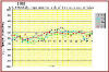
HERE ARE SOME FREQUENTLY ASKED QUESTIONS (FAQ'S):
- QUESTION: WHAT IS A 'WEATHER DATA BROKER' /
CONSULTANT ?
ANSWER: A 'WEATHER DATA BROKER' (ALSO REFERRED TO AS A
'WEATHER DATA CONSULTANT') IS AN INDIVIDUAL WHO IS SPECIALLY TRAINED TO PROVIDE CLIENTS
WITH WEATHER DATA BASED ON THEIR SPECIFIC NEEDS
- QUESTION: WHERE DO 'WDB'S" WORK ?
ANSWER: 'WDB'S WORK INDEPENDENTLY WITH LOCAL AREA
AGENCIES, COMPANIES, AND WEATHER SENSITIVE USERS PROVIDING THEM WITH WEATHER DATA REQUESTS
BASED ON THE UNIQUE NEEDS.
- QUESTION: WHAT DO 'WDB'S" DO ?
ANSWER: WDB'S ARE TRAINED ON HOW TO OBTAIN WEATHER DATA
FOR BOTH GENERAL AND SPECIALIZED USER NEEDS, THE AVAILABILITY OF THE VARIOUS WEATHER DATA
RESOURCES, AND HOW TO COMPILE THE DATA FOR THEIR CLIENTS.
- QUESTION: HOW MUCH DO WDB'S EARN ?
ANSWER: EARNINGS VARY, BUT AVERAGE FROM AROUND $45 TO $75
PER HOUR. YOU CAN SET YOUR OWN HOURS, ENJOY WORK-AT-HOME TAX BENEFITS, AND MUCH
MORE.
- QUESTION: WHAT ARE THE REQUIREMENTS ?
ANSWER: YOU MUST BE 18 YEARS OF AGE OR OLDER TO SIGN UP FOR
THIS PROGRAM. THERE IS NO PREVIOUS EXPERIENCE NECESSARY, BUT YOU MUST HAVE AT LEAST
A HIGH SCHOOL DIPLOMA OR EQUIVALENT (GED) AND BE ABLE TO READ, SPEAK AND UNDERSTAND THE
ENGLISH LANGUAGE..
TAKE THE TIME TO READ ABOUT OUR WEATHER COMPANY OR SEND US AN E-MAIL
-- WE WOULD ENJOY HEARING FROM YOU.
FOR THE WEATHER DATA BROKER / CONSULTANT PROGRAM (WDB)
PLEASE FEEL FREE TO CONTACT US DIRECTLY AT: WXCENTER@AOL.COM OR WXCENTER@AVIATIONWEATHERINC.COM
TODAY !
ONLY $150.00 US DOLLARS COMPLETE -- GUARANTEED !!! E-MAIL
US: WXCENTER@AOL.COM NOW!
REFER TO OUR 'PRODUCTS' PAGE (LISTED AT TOP OF THIS SITE)
FOR ACTUAL SCHEDULING, BOOKING OF AUDITION, INCLUDING
OTHER DETAILS OR INFORMATION.
LEARN ABOUT THE "ASOS" AND HOW IT
COLLECTS WEATHER DATA !!
(GO TO OUR "ASOS" PAGE)
CONTACT US DIRECTLY VIA E-MAIL AT: WXCENTER@AVIATIONWEATHERINC.COM
OR WXCENTER@AOL.COM TODAY !!
COPYRIGHT ©
2000-2001. AVIATION WEATHER, INC. ALL RIGHTS RESERVED.
(BACK
TO TOP)
(GO TO PRODUCTS PAGE)
(BUY
FROM ONLINE STORE)
THE ARCHIVE WEATHER DATA VAULT.
WHETHER YOU ARE AN INSURANCE COMPANY IN NEED OF SPECIFIC WEATHER
DATA TO VALIDATE WEATHER-RELATED DAMAGE CLAIMS, AN ORGANIZATION INVOLVED IN
RESEARCH THAT REQUIRES WEATHER DATA, OR ANY OTHER OPERATION HAVING WEATHER DATA SENSITIVE
NEEDS -- WE CAN HELP WITH OUR WEATHER DATA ARCHIVE VAULT ! WE OFFER
COMPETITIVE RATES AND FAST TURN-AROUND RESPONSE.
OUR STANDARD WEATHER DATA SEARCH FEES START AT $75 PER HOUR TO LOOK
INTO OUR WEATHER DATA VAULT (TWO-HOUR MINIMUM) WITH COST ADJUSTMENTS FOR
SPECIALTY
REQUESTS, COURT CERTIFICATION DATA AND SO ON.
ADDITIONALLY, WE HAVE THE RESOURCES TO HELP CLIENT'S WEATHER
DATA REQUESTS BOTH LOCALLY AND FOR VIRTUALLY ANYWHERE IN THE COUNTRY. IF THE WEATHER
DATA EXISTS AND IS ARCHIVED -- WE CAN LIKELY FIND IT FOR YOU !
LEARN ABOUT THE "ASOS" AND HOW IT
COLLECTS WEATHER DATA !!
(GO TO OUR "ASOS" PAGE)
CLICK HERE WXCENTER@AOL.COM
OR WXCENTER@AVIATIONWEATHERINC.COM
IF YOU WOULD LIKE MORE INFORMATION OR TO SCHEDULE A CONSULTATION TO DISCUSS YOUR
CLIMATIC DATA NEEDS.
COPYRIGHT ©
2000-2001. AVIATION WEATHER, INC. ALL RIGHTS RESERVED.
(BACK
TO TOP)
WELCOME TO: "THE WEATHER CENTER," A SERVICE OF
AVIATION WEATHER, INC. AND THANK YOU FOR
VISITING OUR NEW WEB-SITE. HERE YOU WILL FIND USEFUL INFORMATION ABOUT OUR COMPANY,
ITS SERVICES AND HOW TO CONTACT US DIRECTLY.
- VOICE PHONE:
-
1 - 917 - 372 - 5426 NY.
- ELECTRONIC MAIL:
-
GENERAL INFORMATION:
WXCENTER@AOL.COM
WEBMASTER:
WXCENTER@AVIATIONWEATHERINC.COM
-
FERGUSON, PRESIDENT OF AVIATION WEATHER, INC. IS TAKING
SOME LAST MINUTE READINGS.
SCREEN ACTORS' GUILD & AFTRA TV UNION MEMBER FERGUSON
WORKING WITH FELLOW ACTOR AND PAL CHRIS O'DONNELL (RIGHT) ON THE WARNER
BROS.' "BATMAN & ROBIN" MOVIE SET !!
THANK YOU SO VERY MUCH, FOR TAKING THE TIME TO VISIT US.
WE SINCERELY APPRECIATE ALL OF YOUR E-MAILS, AND LOOK FORWARD TO HEARING
FROM YOU AGAIN.
IN THE MEANTIME, FOLKS ... "KEEP YOUR EYE ON THE SKY."
(BACK
TO TOP)
PLEASE READ THESE 'TERMS & CONDITIONS' CAREFULLY BEFORE USING
THIS WEB-SITE. BY USING THIS SITE YOU SIGNIFY YOUR CONSENT TO THESE 'TERMS &
CONDITIONS'. IF YOU DO NOT AGREE TO THE TERMS, PLEASE DO NOT USE THE SITE.
THE SITE IS OWNED, OPERATED AND MAINTAINED BY "THE WEATHER
CENTER," A SERVICE OF AVIATION WEATHER, INC.
FOR
YOUR PERSONAL ENTERTAINMENT AND INFORMATION. PLEASE FEEL FREE TO BROWSE IN THE
SITE. YOU MAY DOWNLOAD MATERIAL DISPLAYED ON THE SITE FOR NON-COMMERCIAL, HOME
PERSONAL USE ONLY, PROVIDED YOU KEEP INTACT ALL COPYRIGHT, TRADEMARK AND OTHER PROPRIETARY
NOTICES. YOU MAY NOT, HOWEVER, COPY, REDUCE, REPUBLISH, UPLOAD, POST, TRANSMIT OR
REDISTRIBUTE IN ANY WAY THE CONTENTS OF THIS SITE INCLUDING THE TEXT, IMAGES, AUDIO AND
VIDEO FOR PUBLIC OR COMMERCIAL PURPOSES, WITHOUT WRITTEN PERMISSION FROM "THE WEATHER
CENTER," A SERVICE OF AVIATION WEATHER, INC.
TERMS AND CONDITIONS, AS FOLLOWS:
- YOU SHOULD ASSUME THAT EVERYTHING YOU SEE
OR READ ON THIS SITE IS PROTECTED BY COPYRIGHT UNLESS OTHERWISE STATED AND MAY ONLY BE
USED ACCORDING TO THESE 'TERMS & CONDITIONS'. "THE WEATHER CENTER,"
A SERVICE OF AVIATION WEATHER, INC. DOES NOT
WARRANT OR REPRESENT THAT YOUR USE OF MATERIALS DISPLAYED ON THIS SITE WILL NOT INFRINGE
RIGHTS OF THIRD PARTIES NOT OWNED BY OR AFFILIATED WITH "THE WEATHER CENTER,"
A SERVICE OF AVIATION WEATHER, INC. IMAGES ARE EITHER THE
PROPERTY OF, OR USED WITH PERMISSION BY, "THE WEATHER CENTER," A SERVICE OF
AVIATION WEATHER, INC. THE USE OF THESE IMAGES BY YOU OR ANYONE ELSE AUTHORIZED BY YOU, IS
PROHIBITED UNLESS SPECIFICALLY PERMITTED BY THESE 'TERMS & CONDITIONS'. ANY
UNAUTHORIZED USE OF THE IMAGES MAY VIOLATE COPYRIGHT LAWS, TRADEMARK LAWS, THE LAWS OF
PRIVACY AND PUBLICITY, AND COMMUNICATIONS REGULATIONS AND STATUTES.
- "THE WEATHER CENTER," A SERVICE
OF AVIATION WEATHER, INC. USES REASONABLE EFFORTS TO INCLUDE ACCURATE AND UP-TO-DATE
INFORMATION ON THE SITE. HOWEVER, "THE WEATHER CENTER," A SERVICE OF
AVIATION WEATHER, INC. MAKES NO WARRANTIES OR REPRESENTATIONS AS TO THE ACCURACY OF THE
INFORMATION. "THE WEATHER CENTER," A SERVICE OF
AVIATION
WEATHER, INC. ASSUMES NO LIABILITY OR RESPONSIBILITY FOR ANY ERRORS OR
OMISSIONS OF THIS WEB SITE,
FOLLOWS:
WWW.AVIATIONWEATHERINC.COM/
- FURTHERMORE,
YOUR USE OF AND BROWSING IN
THIS SITE IS AT YOUR OWN RISK. NEITHER "THE WEATHER CENTER,"
A
SERVICE OF AVIATION WEATHER, INC. NOR ANY OTHER PARTY INVOLVED IN CREATING, PRODUCING OR
DELIVERING THE SITE IS LIABLE FOR ANY DIRECT, INDIRECT, INCIDENTAL, CONSEQUENTIAL OR
PUNITIVE DAMAGES ARISING OUT OF YOUR ACCESS TO, OR USE OF, THE SITE. WITHOUT
LIMITING THE FOREGOING, EVERYTHING ON THE SITE IS PROVIDED TO YOU "AS IS"
WITHOUT WARRANTY OF ANY KIND, EITHER EXPRESSED OR IMPLIED, INCLUDING, BUT NOT LIMITED TO,
THE IMPLIED WARRANTIES OF MERCHANTABILITY, FITNESS FOR A PARTICULAR PURPOSE, OR
NON-INFRINGEMENT. PLEASE NOTE THAT SOME JURISDICTIONS MAY NOT ALLOW THE EXCLUSION OF
IMPLIED WARRANTIES, OR SOME OF THE ABOVE EXCLUSIONS MAY NOT APPLY TO YOU. CHECK
YOUR LOCAL LAWS FOR ANY RESTRICTIONS OR LIMITATIONS REGARDING THE EXCLUSION OF IMPLIED
WARRANTIES. "THE WEATHER CENTER," A SERVICE OF AVIATION WEATHER, INC. ALSO
ASSUMES NO RESPONSIBILITY AND SHALL NOT BE LIABLE FOR ANY DAMAGES TO, OR VIRUSES THAT MAY
INFECT, YOUR COMPUTER EQUIPMENT OR OTHER PROPERTY ON ACCOUNT OF YOUR ACCESS TO, USE OF, OR
BROWSING IN THE SITE OR YOUR DOWNLOADING OF ANY MATERIALS, DATA, TEXT, IMAGES, VIDEO, OR
AUDIO FROM SITE.
- ANY COMMUNICATION OR MATERIAL YOU
TRANSMIT TO THE SITE BY ELECTRONIC MAIL OR OTHERWISE, INCLUDING ANY DATA, QUESTIONS,
COMMENTS, SUGGESTIONS, OR THE LIKE, IS AND WILL BE TREATED, NON-CONFIDENTIAL AND
NON-PROPRIETARY. ANYTHING YOU TRANSMIT OR POST MAY BE USED BY "THE WEATHER
CENTER," A SERVICE OF AVIATION WEATHER, INC. OR ITS AFFILIATES FOR
ANY PURPOSE, INCLUDING BUT NOT LIMITED TO REPRODUCTION, DISCLOSURE, TRANSMISSION,
PUBLICATION, BROADCAST, AND POSTING. FURTHERMORE, "THE WEATHER CENTER," A
SERVICE OF AVIATION WEATHER, INC. IS FREE TO USE ANY IDEAS, CONCEPTS,
KNOW-HOW, OR
TECHNIQUES CONTAINED IN ANY COMMUNICATION YOU SEND TO THE SITE FOR ANY PURPOSE WHATSOEVER,
INCLUDING BUT NOT LIMITED TO DEVELOPING, MANUFACTURING, AND MARKETING PRODUCTS USING SUCH
INFORMATION.
- THE TRADEMARKS AND LOGOS DISPLAYED ON THE
SITE, OR THOSE IN-CONJUCTION THROUGH HYPER-LINKS THROUGH CLIENTS' WEB-SITES, ARE
TRADEMARKS OF "THE WEATHER CENTER," A SERVICE OF AVIATION
WEATHER, INC. AND OTHERS. NOTHING CONTAINED ON THE SITE SHOULD BE CONSTRUED
AS GRANTING, BY IMPLICATION, STOPPED, OR OTHERWISE, ANY LICENSE OR RIGHT TO USE ANY
TRADEMARK DISPLAYED ON THE SITE WITHOUT WRITTEN PERMISSION OF "THE WEATHER
CENTER," A SERVICE OF AVIATION WEATHER, INC. OR SUCH THIRD PARTY
THAT MAY OWN THE TRADEMARKS DISPLAYED ON THE SITE.
- "THE
WEATHER CENTER," A SERVICE OF AVIATION WEATHER, INC. HAS NOT FULLY
REVIEWED ALL OF THE SITES LINKED TO THE SITE AND IS NOT RESPONSIBLE FOR
THE CONTENTS OF ANY OFF-SITE PAGES OR ANY OTHER SITES LINKED TO THE SITE.
YOUR LINKING TO ANY OTHER OFF-SITE PAGES OR OTHER SITES IS AT YOUR OWN
RISK.
- OUR PRIVATE E-MAIL FACILITIES ARE NOT
YOUR ADVERTISING MEDIUM. PEOPLE WHO USE THEM AS SUCH ABUSE OUR RESOURCES AND WASTE
OUR TIME, WHICH WE FEEL ARE PRETTY VALUABLE. UNSOLICITED ADVERTISING MESSAGES SENT
OVER TELEPHONE LINE DATA DEVICES IS IN VIOLATION OF THE FEDERAL TELEPHONE CONSUMER
PROTECTION ACT OF 1991, AND COLLATERAL CODE OF FEDERAL REGULATIONS (47 CFR 64. 1200).
THE TCPA ALLOWS A PRIVATE RIGHT OF ACTION AGAINST THE SENDER OF UNSOLICITED
ADVERTISING. THE RECIPIENT CAN SUE FOR $500, OR ACTUAL DAMAGES (WHICHEVER IS
GREATER).
- "THE WEATHER CENTER,"
A
SERVICE OF AVIATION WEATHER, INC. MAY AT ANY TIME REVISE THESE 'TERMS &
CONDITIONS' BY UPDATING THIS POSTING. YOU ARE BOUND BY ANY SUCH REVISIONS AND
SHOULD THEREFORE PERIODICALLY VISIT THIS SECTION / PAGE TO REVIEW THE CURRENT 'TERMS &
CONDITIONS' TO WHICH YOU ARE BOUND.
CONTACT US DIRECTLY VIA E-MAIL AT: WXCENTER@AVIATIONWEATHERINC.COM
OR WXCENTER@AOL.COM TODAY !!
COPYRIGHT ©
2000-2001. AVIATION WEATHER, INC. ALL RIGHTS RESERVED.
(BACK
TO TOP)
AGAIN, THANK YOU FOR VISITING US, OUR SPONSORS' HOMEPAGES, AND OUR
ONLINE STORE PRODUCTS.
ASK US ABOUT: RAIN GAUGE WITH RAIN DATA LOGGER RENTALS FOR JUST $100
PER DAY INCLUDES ALL. THE TIPPING BUCKET AND WATERPROOF (RAIN DATA LOGGER)
ATTACHMENT WILL RECORD ALL YOUR MEASUREMENTS WITH DETAILED RAINFALL HISTORY.
PERFECT FOR MAJOR FILM PROJECTS AND TV COMMERCIAL INDUSTRY, OR ANY OUTDOOR
EVENTS, WHICH ARE INSURED BY INSURANCE PROVIDERS.
HOME TO THE OFFICIAL 'LIVE WEATHER LAB' FOR ALL HUMAN WEATHER OBSERVERS IN
THE USA.
SA 0950 -X 200 SCT 21/2F
173/51/51/2105/004/F3 tm


|
|
|

www.aviationweatherinc.com:
WELCOME TO OUR 'HOME' PAGE.
HERE YOU WILL FIND USEFUL INFORMATION,
LISTED WITHIN THIS SITE, CONCERNING:
-
"THE WEATHER CENTER,"
-
AVIATIONWEATHERINC.COM,
-
AVIATION WEATHER, INCORPORATED,
-
THE 'WEATHER' ON THE HORIZON,
-
AND THEN SOME.
PLUS 'MORE WEATHER' SUCH AS: TORNADO SAFETY RULES ...
FROM AVIATIONWEATHERINC.COM !!
.
COMMENT:
WEATHER PRODUCTS WITHIN THIS SITE, HAVE BEEN MADE
POSSIBLE, IN PART, BY OUR PAID SPONSORS. PLEASE VISIT OUR SPONSORS.
AVIATIONWEATHERINC.COM SUBSCRIBERS MEMBERSHIP SERVICES: FREQUENTLY
ASKED QUESTIONS, FORGET YOUR PASSWORD? OR SIGN-UP FOR FREE TRIAL WITH US.
JUST POINT AND CLICK: WXCENTER@AVIATIONWEATHERINC.COM
IF YOU NEED TO SEND US AN EMAIL OR GET A HOLD OF US, FOR ANY REASON.
THANK YOU FOR TAKING THE TIME TO VISIT US
FOR AVIATIONWEATHERINC.COM ONLINE SUBSCRIBERS,
IF NOT REGISTERED, YOU WILL HAVE ONLY LIMITED
ACCESS TO OUR WEATHER DATABASE.
PICK YOUR LANGUAGE FROM CATEGORY:
TORNADO SAFETY RULES:
YOU MUST
REALIZE THAT TORNADOES APPEAR SUDDENLY AND STRIKE RANDOMLY, WITHOUT WARNING.
A TORNADO
APPEARS AS A ROTATING, FUNNEL-SHAPED CLOUD, STRIKING THE GROUND WITH
WHIRLING WINDS UP TO 200 MILES PER HOUR. A TORNADO SPINS LIKE A TOP,
AND MAY SOUND LIKE AN AIRPLANE OR TRAIN. MOST TORNADOES TRAVEL A
DISTANCE OF ABOUT 10 MILES, BUT SOME HAVE BEEN REPORTED TO TRAVEL UP TO 250
MILES.
TORNADOES CAN HAPPEN ALMOST ANYWHERE IN THE U.S. AND CAN FORM ANY
TIME OF THE YEAR, BUT MAY AND JUNE ARE THE PEAK MONTHS. OH, AND DON'T TRY TO CHASE
THE TORNADO EITHER !!
YOUR BEST DEFENSE AGAINST TORNADOES IS TO BE ALERT DURING TIMES OF
SEVERE WEATHER, ESPECIALLY WHEN 'WATCHES' OR 'WARNINGS' HAVE BEEN ISSUED IN YOUR AREA.
A 'WATCH' IS WHEN WEATHER CONDITIONS ARE RIGHT FOR THE DEVELOPMENT OF
TORNADOES.
IF A TORNADO 'WARNING' IS BEING ISSUED FOR YOUR AREA, SEEK IMMEDIATE
SHELTER IN THE LOWEST LEVEL OF YOUR HOME (A BASEMENT OR STORM CELLAR).
IF YOU DO NOT HAVE A BASEMENT, GO TO THE INNER HALLWAY, A SMALL INNER
ROOM (BATHROOM), OR A CLOSET.
STAY AWAY FROM WINDOWS. KEEP CURTAINS AND SHADES CLOSED, TOO.
ALSO, KEEP YOUR PET ON A LEASH OR IN A CARRIER NEXT TO YOU, AND
CUSHION YOURSELF WITH A MATTRESS, BUT DO NOT USE ONE TO COVER YOURSELF OR YOUR PET !!
COVER YOUR HEAD AND EYES WITH A BLANKET TO PROTECT YOURSELF AGAINST
FLYING DEBRIS AND BROKEN GLASS.
IF YOU ARE IN A
MOBILE HOME, OUTSIDE, OR IN A CAR, TAKE SHELTER
IMMEDIATELY IN A BASEMENT OR NEARBY STURDY STRUCTURE, OR LIE FLAT IN A DITCH OR LOW-LYING
AREA. ALSO, COVER YOUR HEAD AND NECK WITH YOUR ARMS OR A PIECE OF CLOTHING.
FROM AVIATIONWEATHERINC.COM !! |
|